
Tropical Disturbance in Gulf May Bring Heavy Rain, Rip Currents to Southeast Texas
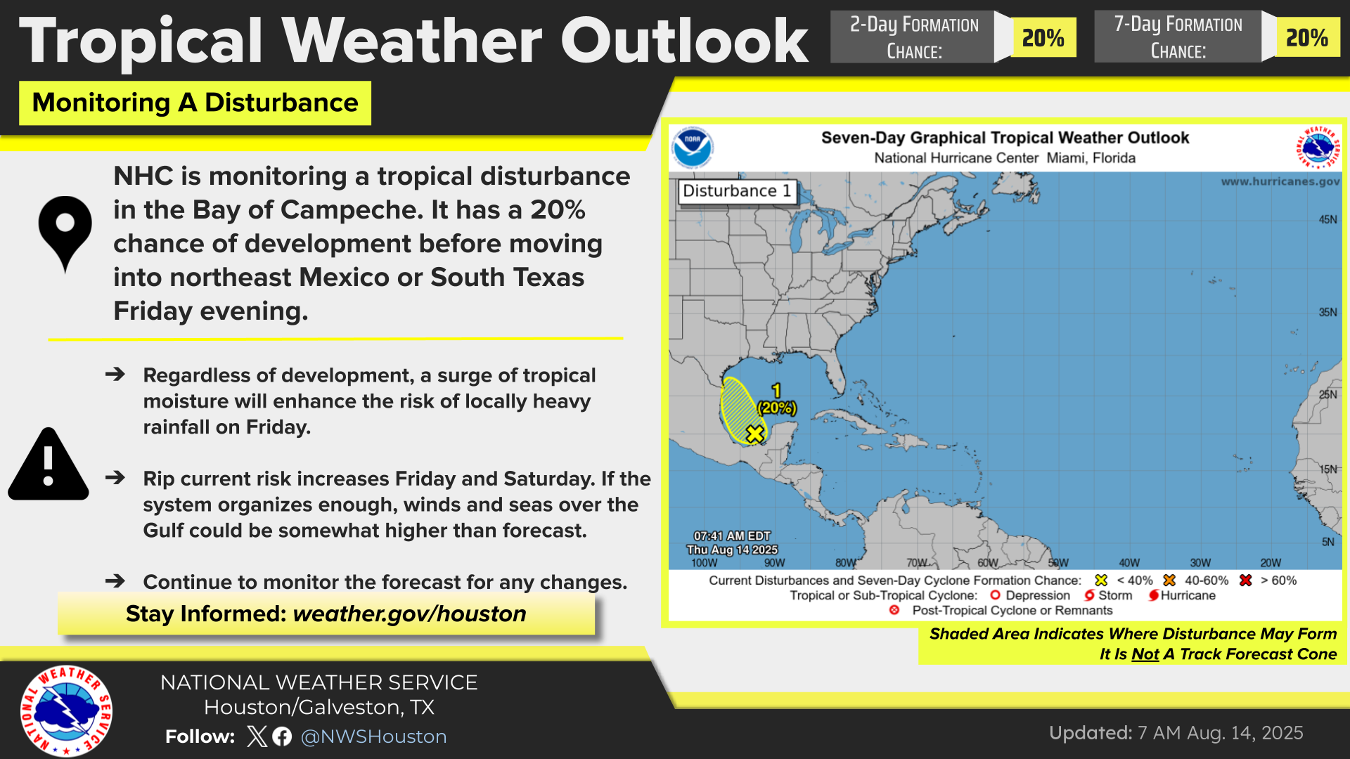
The National Hurricane Center (NHC) is monitoring a weak tropical disturbance currently located in the Bay of Campeche. While the system has only a 20% chance of tropical cyclone developmentover the next two days, Southeast Texas residents—especially along the coast—should be prepared for increased rainfall and dangerous beach conditions starting Friday.
According to the Houston-Galveston Office of the National Weather Service, the disturbance is forecast to move west-northwest across the southwestern Gulf of Mexico before likely making landfall in either northeast Mexico or South Texas by Friday evening. Given its limited time over open water, the chances of further strengthening remain low.
What Southeast Texas Residents Can Expect
Although the system may not develop into a named storm, tropical moisture is already surging into the region. Here's what to be aware of:
-
Increased Rainfall: Expect 30% to 65% rain chances Friday, particularly near the coast and over adjacent Gulf waters. Some areas could see locally heavy downpours, which may affect outdoor plans or lead to minor flooding in low-lying areas.
-
Strong Rip Currents: All Gulf-facing beaches, including Galveston and Surfside, will face a heightened rip current risk Friday and Saturday. Beachgoers should use extreme caution and swim near lifeguards if visiting the coast.
-
Choppy Seas & Gusty Winds: If the disturbance becomes better organized, winds and wave heights could exceed current forecasts, especially offshore.
“Even without full tropical storm development, we’ll likely see enhanced weather impacts on Friday,” notes the NWS Houston-Galveston office. “Conditions on area beaches may be hazardous for swimmers, and downpours could be brief but intense.”
Stay tuned to official updates at weather.gov/houston.
 (Source: National Weather Service - Houston/Galveston)
Why Early Preparation Still Matters
While this particular system is expected to have limited impact, hurricane season is far from over. With several months remaining in the Atlantic hurricane season, now is the time to ensure your household is ready for more serious storms that may develop.
Here are 5 key preparedness tips you can act on today:
Top Things to Do Before a Storm Forms
Review Your Emergency Plan
Discuss evacuation routes, meeting points, and communication strategies with your family.
Check Your Supplies
Stock up on non-perishable food, water (1 gallon per person per day for 3 days), flashlights, batteries, first-aid kits, and necessary medications.
Secure Important Documents
Store insurance papers, IDs, and home inventory photos in waterproof containers or upload copies to the cloud.
Sign Up for Local Alerts
Subscribe to city, county, or NWS emergency alerts to receive real-time updates for your area.
Inspect Your Property
Trim branches, clear gutters, and check your roof for vulnerabilities before a storm hits—not during.
For a complete guide, visit ready.gov/hurricanes.
Stay Weather-Aware as the Weekend Approaches
Forecasts may shift, especially if the disturbance organizes more rapidly than expected. Southeast Texas residents are encouraged to check the forecast regularly and avoid complacency—even during "minor" systems.
If you own a home near the coast or plan to visit Gulf beaches this weekend, please remain cautious, follow local advisories, and avoid risky water activities during periods of high surf and strong currents.
Follow My Neighborhood News for more weather updates, local safety alerts, and hurricane prep guides tailored to your community.
 Tiffany Krenek has been on the My Neighborhood News team since August 2021. She is passionate about curating and sharing content that enriches the lives of our readers in a personal, meaningful way. A loving mother and wife, Tiffany and her family live in the West Houston/Cypress region.