Houston-Area Residents Urged to Stay Indoors as Arctic Blast Brings Dangerous Cold, Icy Roads, and Power Risks
As Southeast Texas braces through one of the coldest weather events in recent years, officials from ReadyHarris and the National Weather Service (NWS) Houston/Galveston are sounding the alarm: stay indoors, stay safe, and stay informed.
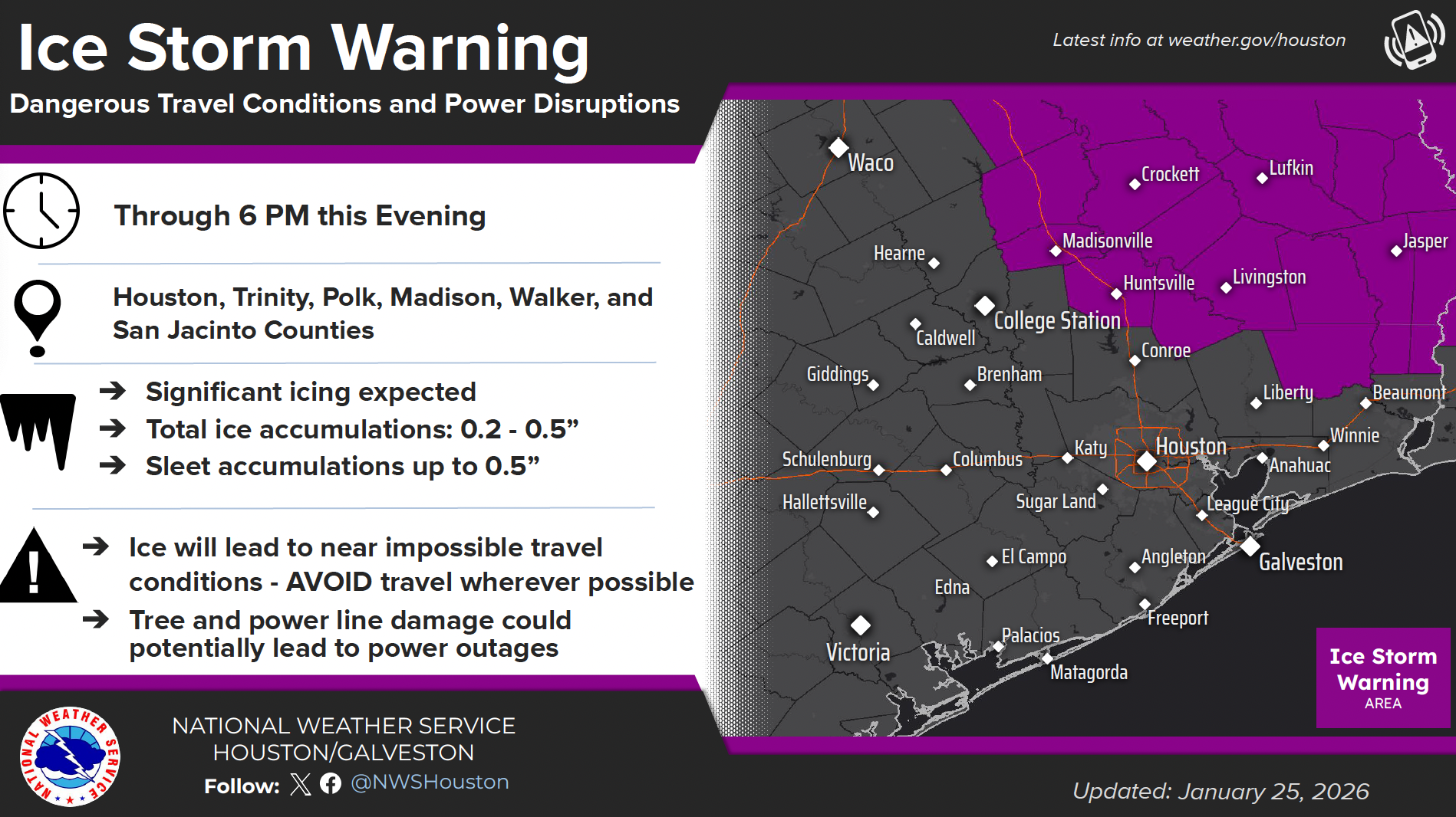
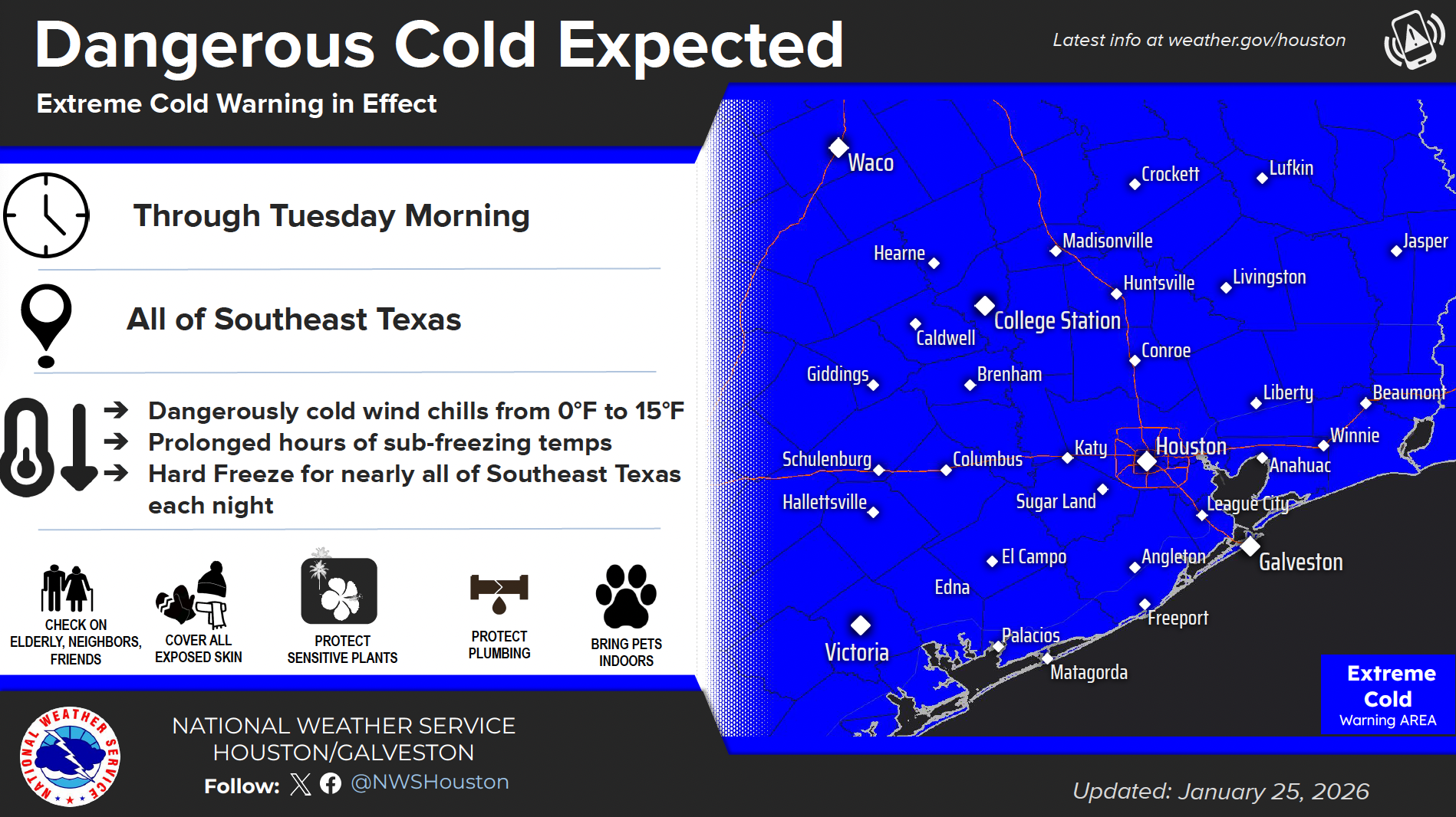
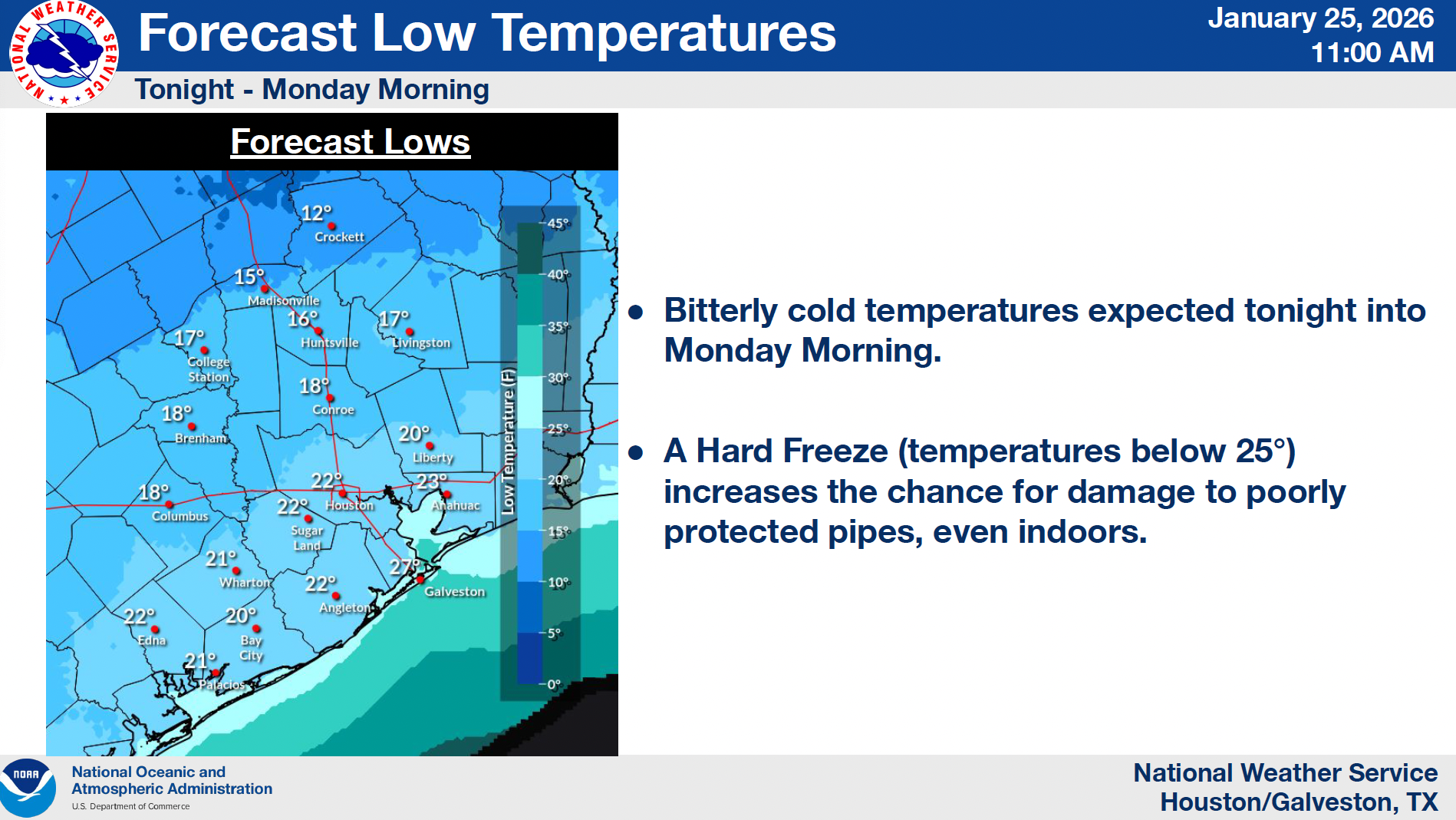
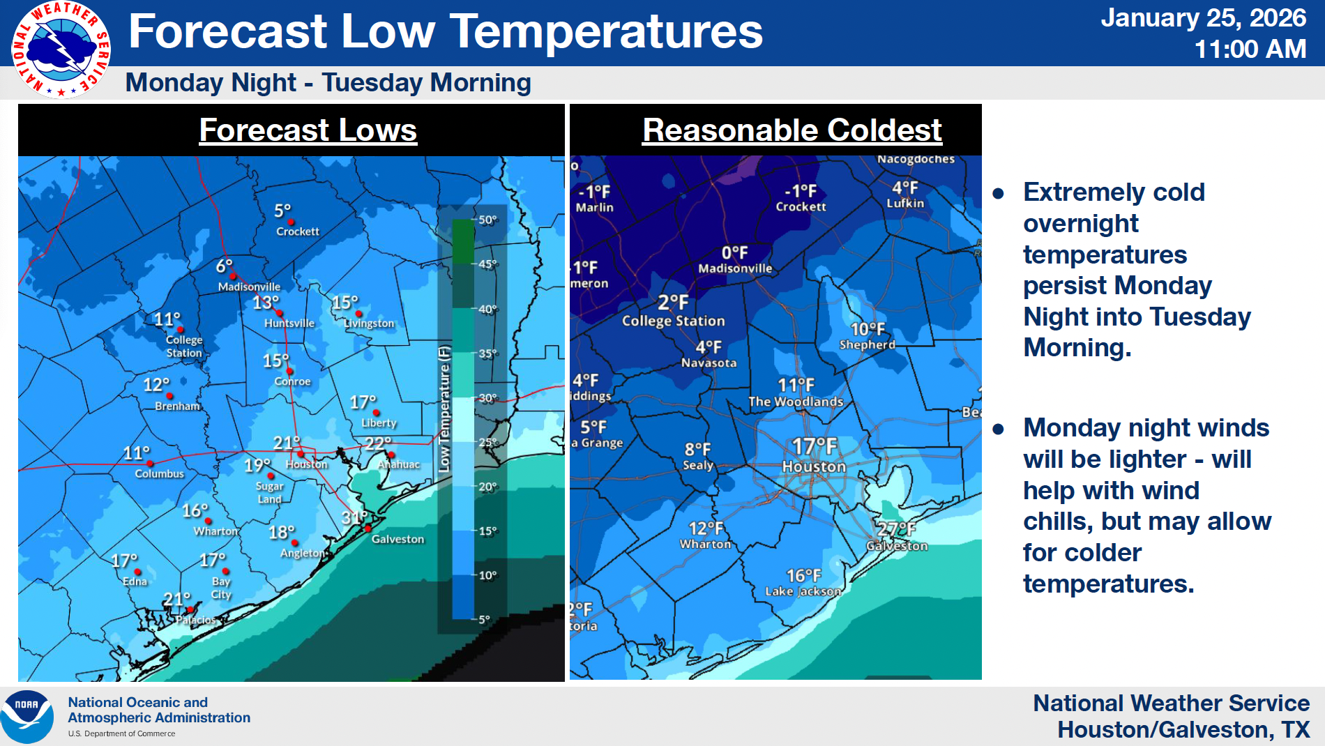
The arctic front that swept through the region on Sunday has ushered in a prolonged and dangerous period of sub-freezing temperatures, freezing rain, and icy roads. An Extreme Cold Warning remains in effect through Tuesday morning, with wind chills dipping as low as 0°F to 15°F and widespread hard freezes expected overnight across the Houston area.
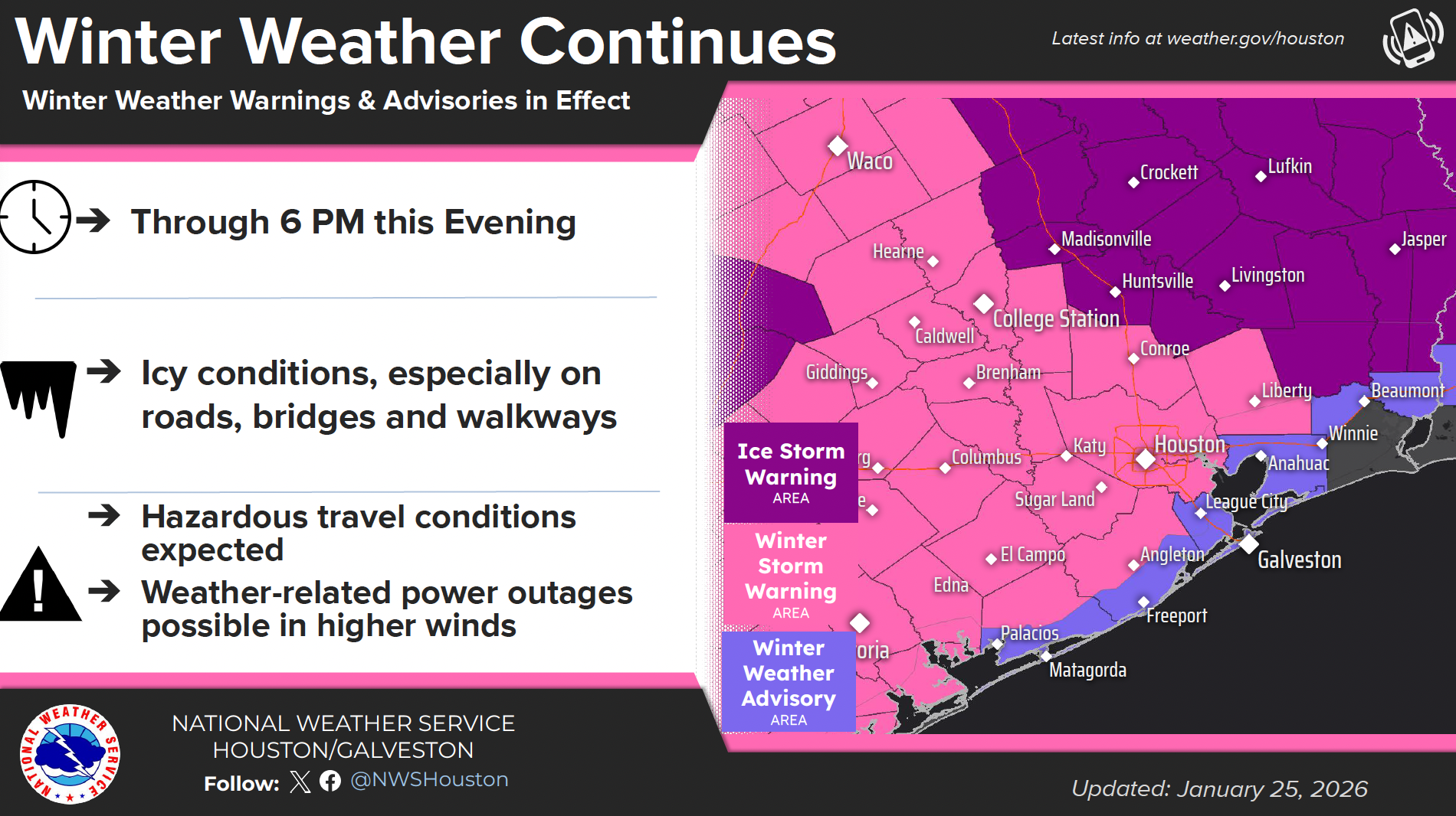
Roadways and Travel Conditions in Houston and Beyond
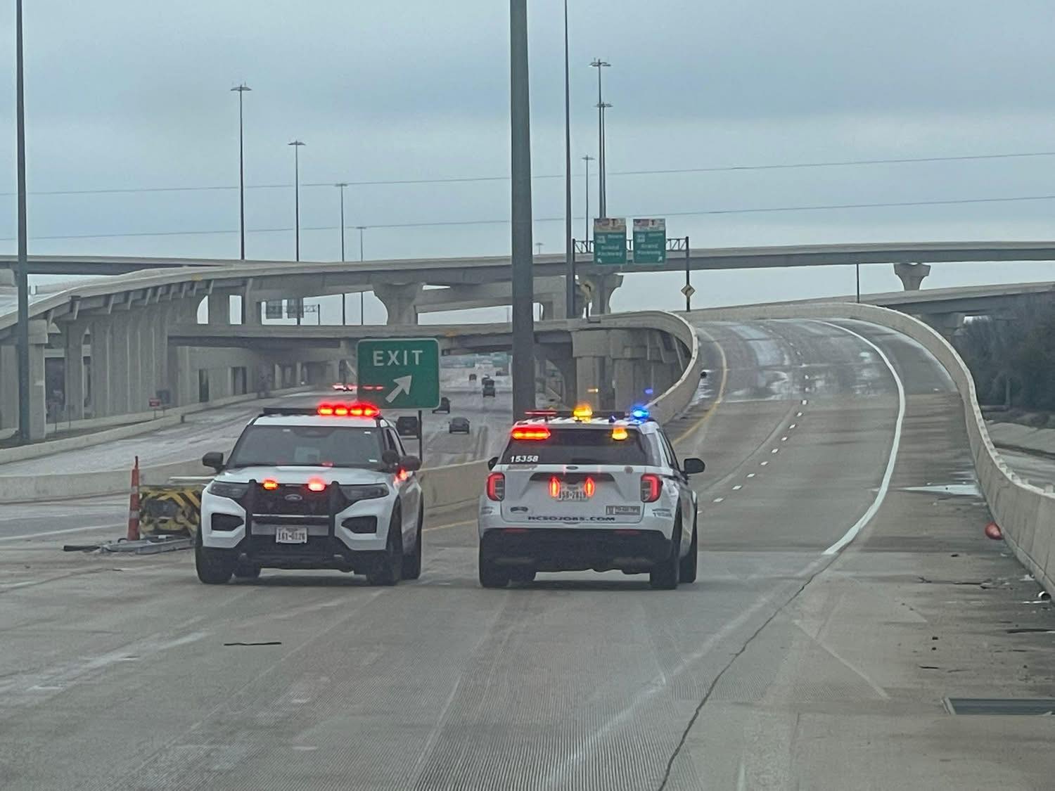
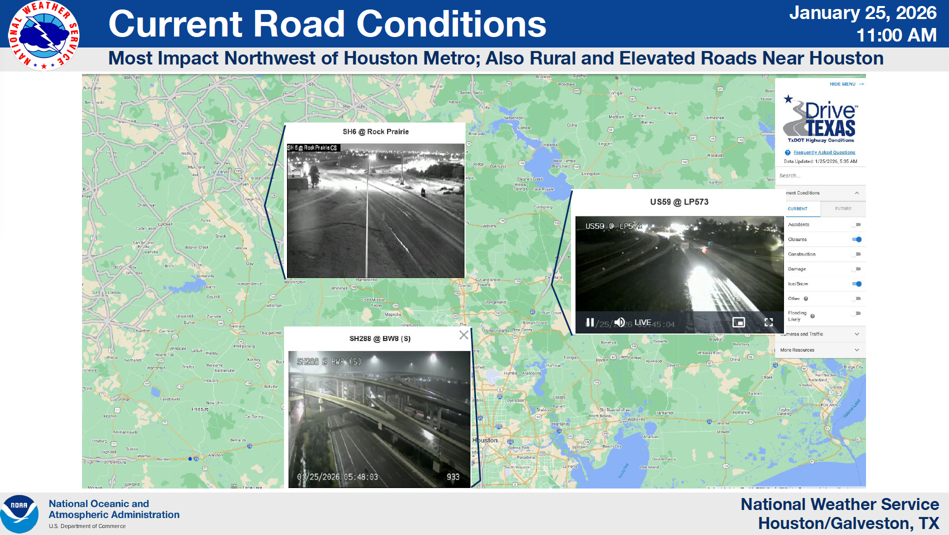
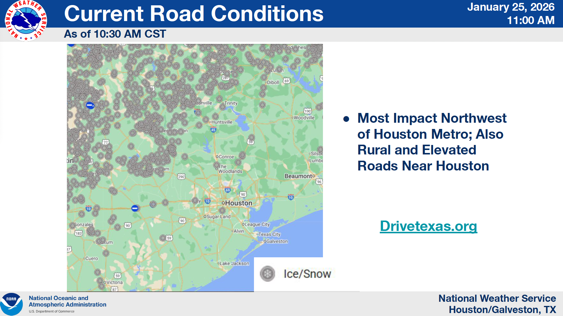
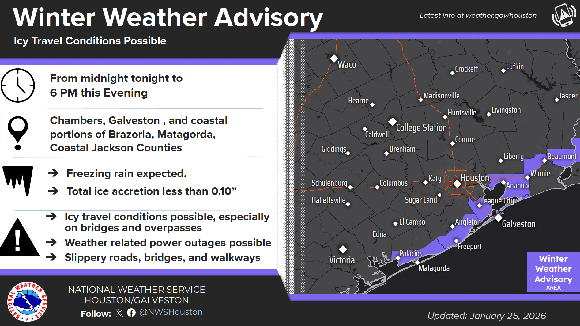
While the worst of the precipitation has moved out of the region, the danger is far from over. Icy roads, bridges, and overpasses continue to pose significant threats, particularly northwest of Houston and in rural and elevated areas surrounding the city. According to DriveTexas and NWS, these areas remain hotspots for icy hazards.
"ANY wet surfaces will freeze," ReadyHarris officials emphasized. "This includes roads, bridges, and walkways, making travel extremely dangerous."
Residents are strongly urged to stay off the roads unless absolutely necessary. The potential for power outages due to ice-laden tree limbs and wind gusts up to 35 mph adds another layer of risk.
How Cold Will It Get?
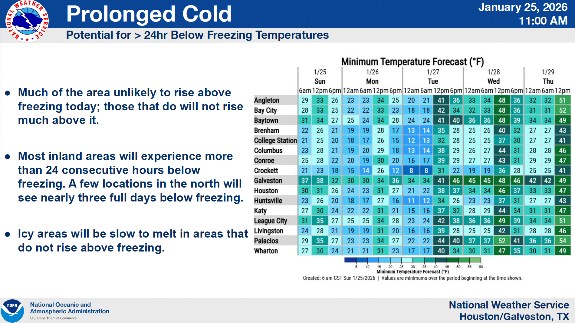
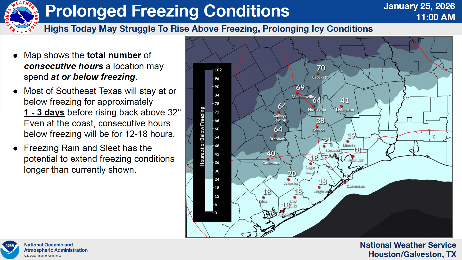
Forecasts show the region will experience several consecutive nights of dangerously low temperatures, with some areas remaining below freezing for over 24 hours. Parts of northern Harris County and the Piney Woods could see nearly three full days below freezing, with lows dipping into the teens.
And it’s not just about the thermometer. The “feels-like” temperatures—wind chills—are expected to remain hazardous through Tuesday afternoon, with some northern areas experiencing sub-zero readings.
Safety Measures Every Household Should Follow
Local officials are urging all residents to “Stick to the Plan”—a phrase being widely used in emergency communications. Here’s what that means:
- Protect the 4 Ps: People, Pets, Pipes, and Plants.
- Stay indoors whenever possible.
- Cover all exposed skin when outside to avoid frostbite.
- Check on neighbors, especially the elderly and those with limited mobility.
If you discover a burst pipe:
- Shut off the main water line immediately (how-to guide).
- Contact a professional for safe repairs.
- Look for signs such as low water pressure, frost on pipes, or damp walls.
Where to Find Shelter and Help
Multiple warming centers and overnight shelters are open across Harris County. Residents can visit ReadyHarris.org for a daily updated map of available locations and hours. If transportation is a barrier, call 3-1-1 for assistance.
For non-emergency questions or updates, text FREEZE to 888-777 to receive winter weather alerts directly to your phone.
Emergency personnel are experiencing a surge in service calls and longer response times. Residents should only call 9-1-1 for life-threatening emergencies.

Space Heater & Generator Safety Tips
Space heaters are a leading cause of home fires during winter months. ReadyHarris and the Harris County Fire Marshal stress the following:
- Keep heaters at least 3 feet away from anything flammable.
- Plug directly into a wall—never use extension cords.
- Turn off heaters when leaving the room or going to sleep.
- Keep heaters out of reach of children.
Generator usage, especially indoors or in enclosed spaces, can lead to carbon monoxide poisoning. Always run generators outside and at least 15-20 feet away from doors and windows.
What’s Next?
According to the NWS Five-Day Outlook, a slow warming trend is expected by midweek, with highs climbing into the 40s and 50s by Wednesday. However, light freezes are likely to persist through Thursday in many areas
In the meantime, community vigilance and cooperation remain critical. Stay connected to official sources like ReadyHarris.org and weather.gov/houston, and continue monitoring local media and school district alerts for the latest updates.
Helpful Resources for Houston Area Residents
- Live Traffic Conditions: HoustonTranstar.org
- Statewide Road Conditions: DriveTexas.org
- Warming Center Map & Emergency Updates: ReadyHarris.org
- Winter Weather Alerts: Text FREEZE to 888-777
Stay safe, Houston. Warmer days are ahead, but for now, the best plan is to stay indoors, stay alert, and take care of each other.
 Tiffany Krenek has been on the My Neighborhood News team since August 2021. She is passionate about curating and sharing content that enriches the lives of our readers in a personal, meaningful way. A loving mother and wife, Tiffany and her family live in the West Houston/Cypress region.