







UT San Antonio Flood Warning Research Could Give Texas Communities Earlier, More Localized Alerts
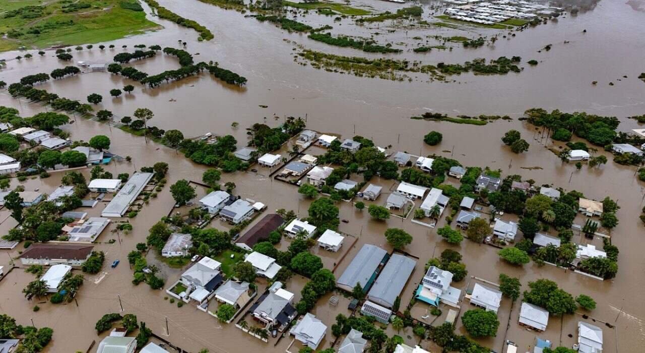
When heavy rain moves across San Antonio, conditions can change quickly from one street to the next. A low-water crossing may become dangerous while nearby roads remain passable, and drainage areas behind neighborhoods can begin filling before broader weather alerts fully reflect what is happening on the ground.
Researchers at The University of Texas at San Antonio are working on a technology designed specifically for that gap.
A team led by Chen Pan, Ph.D., assistant professor of electrical engineering in UT San Antonio’s Margie and Bill Klesse College of Engineering and Integrated Design, has developed a self-powered, artificial intelligence-based flood warning system capable of monitoring localized conditions without relying on the electric grid, cellular service or traditional internet connections.
The research was detailed in a Sept. 8 report by Audrey Gray for UT San Antonio Today, which described the project as a field-ready prototype aimed at detecting dangerous water accumulation at the street level.
For communities across San Antonio and Texas where flash flooding can develop rapidly, the potential benefit is straightforward: more localized information, delivered sooner, could help emergency officials decide when to close roads, dispatch crews or warn residents before water reaches its highest levels.
Why Hyper-Local Flood Detection Matters in San Antonio
Regional weather models, radar and satellite imagery remain essential tools for forecasting storms, but flooding does not always develop evenly across a city.
A drainage channel behind a subdivision, a rural roadway, a low-water crossing or a neighborhood access point may flood while surrounding areas experience much less water. That makes street-level monitoring especially important in places where elevation, drainage and rainfall intensity can vary over short distances.
“In many rural areas or coastal communities, power infrastructure can fail right when severe weather strikes,” Pan said in the UT San Antonio report. “Our system is an off-grid solution. It generates its own power, evaluates flood risk locally right on the device and sends timely warnings without needing external electricity or expensive network lines.”
Pan directs UT San Antonio’s RISE Lab. The research team also includes Mimi Xie, assistant professor of computer science in UT San Antonio’s College of AI, Cyber and Computing, along with Texas A&M University-Corpus Christi researchers Hua Zhang, professor of engineering, and Wenlu Wang, assistant professor of computer science.
How the Smart Flood Warning System Works
The prototype combines several technologies into one relatively compact monitoring station.
Sensors track temperature, humidity, light and precipitation, while four optical water-level sensors are mounted at different heights. By considering several environmental measurements at the same time, the system can evaluate changing flood conditions using what researchers call multi-modal sensing.
That is different from traditional systems that may rely heavily on one measurement, such as water level alone.
The technology also uses TinyML, a form of machine learning designed to run directly on small, low-power computer chips.
That matters during severe weather because many conventional Internet of Things devices send raw data to remote cloud servers for analysis. If cellular towers, electricity or internet service go down, that communication chain can be disrupted.
UT San Antonio’s system is designed to process flood-risk information directly on the monitoring device instead.
According to the university, the artificial intelligence model achieved 98.82% validation accuracy in initial post-training assessments.
Solar Power Could Keep Sensors Running During Outages
Another key part of the design is its power source.
The flood-monitoring node uses solar energy harvesting to charge a built-in battery and backup energy storage units. Researchers designed the system to operate using substantially less power than a smartphone, allowing it to remain active through extended storms and cloudy conditions.
That off-grid approach could be especially important during hurricanes, tropical systems and severe thunderstorms, when conventional electricity may be unavailable precisely when flood monitoring is most needed.

When rising water is detected, the system transmits information through LoRa, or Long Range, wireless technology.
According to UT San Antonio, those low-power signals can travel more than a half-mile through urban streets and as far as five miles in open areas without depending on cellular towers or wired infrastructure.
A Dashboard Could Help Officials See Where Flooding Is Headed
Individual sensors represent only one part of the system.
At a central monitoring location, software can combine information from multiple sensor nodes placed throughout a community or watershed. A larger AI model then evaluates how conditions are changing across different locations and produces predictive flood maps on a web-based dashboard.
“The user doesn’t need to decipher raw data,” Pan said. “The dashboard assesses risk levels and shows how flooding could spread across monitored locations, highlighting higher-risk zones so local officials can act quickly.”
In practical terms, that could give emergency personnel another source of real-time information when deciding whether to close a road, send crews into a particular area or issue a warning focused on one neighborhood rather than an entire region.
For residents, that kind of precision could eventually mean receiving information that better reflects what is happening close to home.
Researchers Are Working Toward Real-World Deployment
Cost was also part of the design.
Rather than relying on highly specialized hardware, Pan built the prototype with commercially available components. The parts for one sensing station currently cost approximately $150 to $220, according to UT San Antonio.
Pan is pursuing patent protection for the hardware architecture, and the research team hopes to develop the prototype into a more polished, weather-resistant commercial product.
Possible users could include small coastal cities, homeowners associations, agricultural operations, industrial facilities and local governments responsible for roads and drainage.
“Our ultimate goal is to get this technology deployed where it’s needed most,” Pan said. “Whether along the Gulf Coast, across rural Texas counties or in urban drainage basins, smart self-powered sensing can give communities the early awareness they need to stay safe.”
What the Research Could Mean for Texas Communities
The project remains in the development and commercialization stage, so the system is not yet a replacement for existing National Weather Service alerts, flood-control infrastructure or local emergency management procedures.
Its potential value instead lies in adding another layer of information at places where flooding often becomes dangerous first — individual streets, drainage channels, low-water crossings and neighborhood access points.
For San Antonio residents who have seen storms affect one part of town very differently from another, that street-level focus may be the most significant part of the research.
The project was funded in part through a Texas Coastal Management Program grant approved by the Texas Land Commissioner, with financial assistance under the Coastal Zone Management Act and funding awarded by the National Oceanic and Atmospheric Administration’s Office for Coastal Management. The UT San Antonio report notes that views associated with the project do not necessarily represent those of NOAA, the U.S. Department of Commerce or related agencies.
As the research moves from prototype toward possible deployment, the work offers a glimpse at how artificial intelligence, low-cost sensors and off-grid technology could become part of the broader effort to improve flood safety across San Antonio, coastal Texas and other flood-prone communities.
Stay tuned to My Neighborhood News for updates on San Antonio research, flood preparedness, public safety technology and other developments affecting local communities.
Source credit: Reporting and project information were drawn from the Sept. 8, 2026 UT San Antonio Today article by Audrey Gray, “UT San Antonio researcher builds self-powered, smart warning system to catch local floods before disaster strikes."

 Tiffany Krenek has been on the My Neighborhood News team since August 2021. She is passionate about curating and sharing content that enriches the lives of our readers in a personal, meaningful way. A loving mother and wife, Tiffany and her family live in the West Houston/Cypress region.
Local business spotlight
Grow your business
where trust already lives.
Let’s introduce your business to the neighbors nearby.
Have a local favorite?
Let’s make an introduction.
Leave your email and our team will reach out with ways to promote your business.
Give a local favorite a little love.
Know a business your neighbors should discover? Tell us who they are.
We couldn’t send that just yet. Please try again.