
Southeast Texas Faces Intense Heat: Excessive Heat Warnings in Effect as Temperatures Soar
The National Weather Service - Houston/Galveston has issued an Excessive Heat Warning for most of the Southeast Texas region, with temperatures expected to soar today and continue through tomorrow. Residents are strongly urged to stay safe and take precautions.
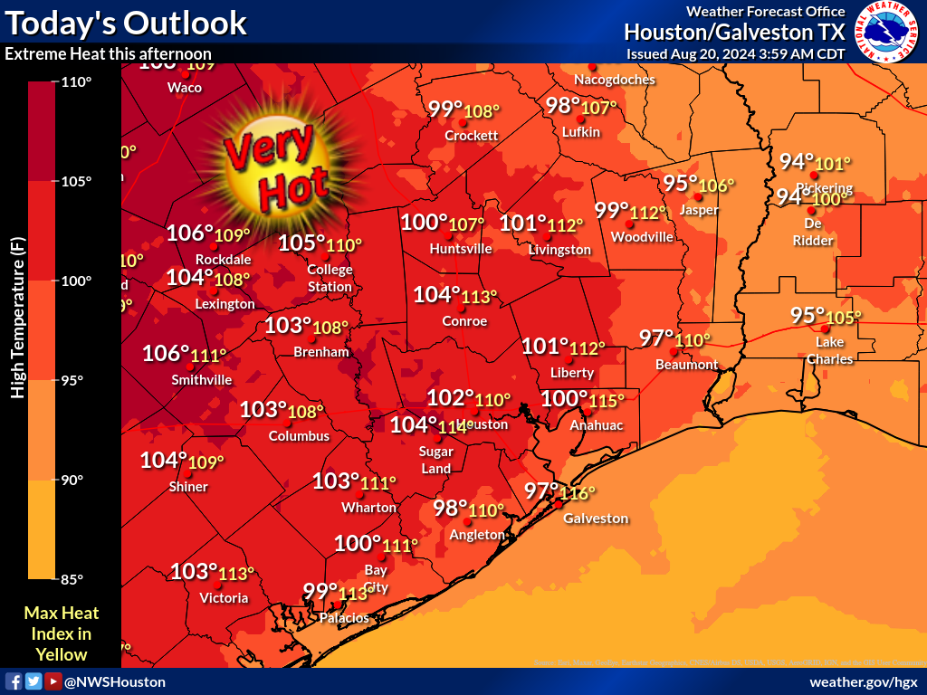
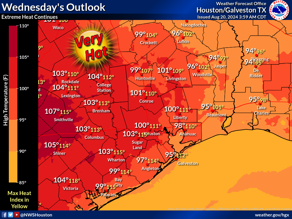
As the region slips into the grips of the hottest days of the year so far, temperatures are expected to rise alarmingly, hitting between 100-105°F during the day. The afternoons will be even more challenging with heat indices likely to reach a scorching 111-116°F. This dangerous heat will only intensify with minimum overnight heat indices treading in the mid-80s to low 90s, even flaring near 100°F along the immediate coast.
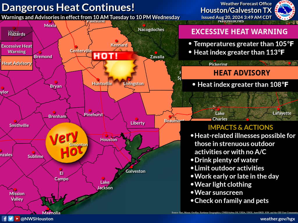
To help residents cope, Excessive Heat Warnings will be enforced from 10:00 AM today, remaining in effect until 10:00 PM Wednesday. Such warnings extend to all counties in Southeast Texas, except Madison, Walker, San Jacinto, Polk, Trinity, and Houston counties, where a Heat Advisory has been issued. The Warning and Advisory will remain in place overnight given the limited cooling expected.
 |
 |
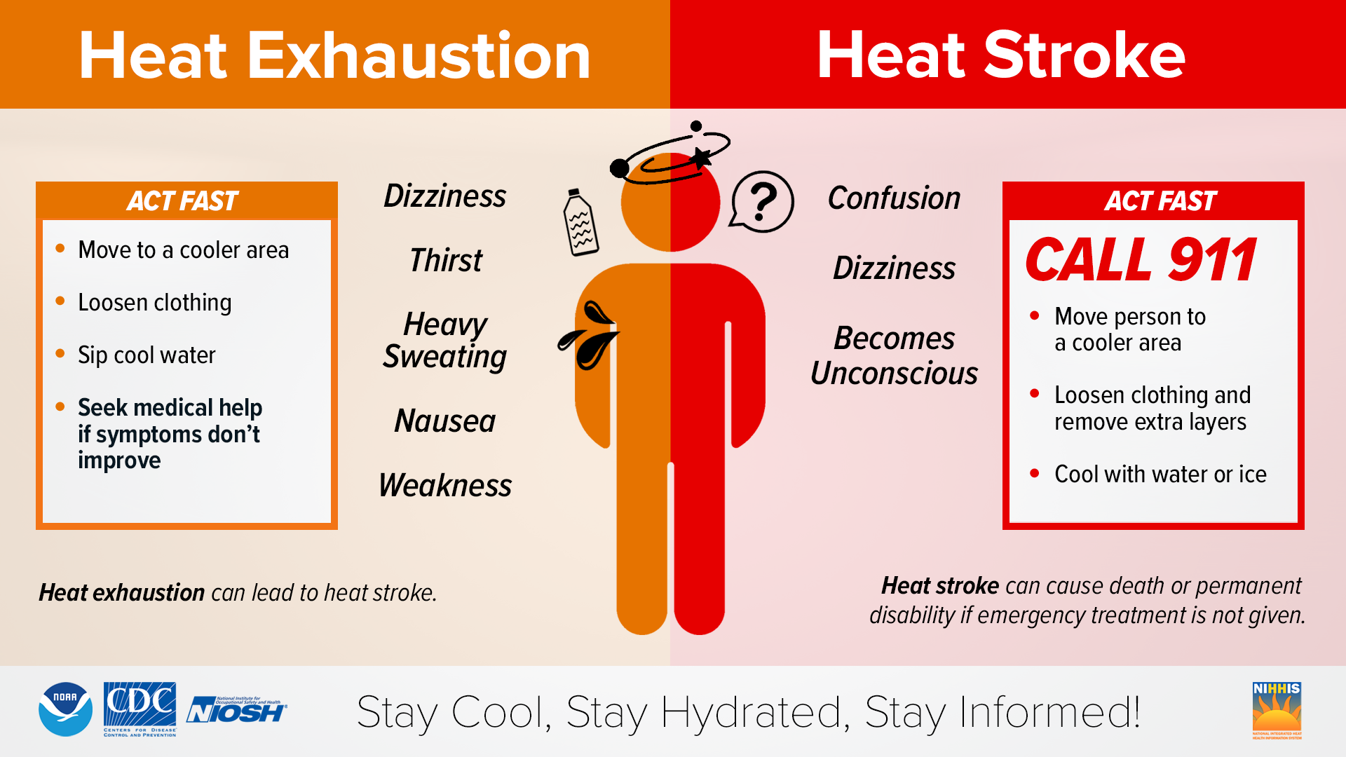
In a statement, the National Weather Services underscored the preventability of heat-related deaths, urging residents to protect themselves and others. For those at job sites, regularly hydrate and take shade breaks. The elderly, the sick, and those without air conditioning need to be checked upon regularly indoors.
On a cautionary note, vehicles should never be left with kids or pets unattended - a quick check is always necessary before locking. Strenuous outdoor activities should be limited, with individuals encouraged to seek shade and stay hydrated. The update also reminded that large cities often bear higher temperatures than surrounding areas due to a phenomenon known as the urban heat island effect due to the heat-absorptive surfaces, such as dark pavement and buildings.
Stay tuned for additional updates at weather.gov/hgx.
 Tiffany Krenek has been on the My Neighborhood News team since August 2021. She is passionate about curating and sharing content that enriches the lives of our readers in a personal, meaningful way. A loving mother and wife, Tiffany and her family live in the West Houston/Cypress region.