







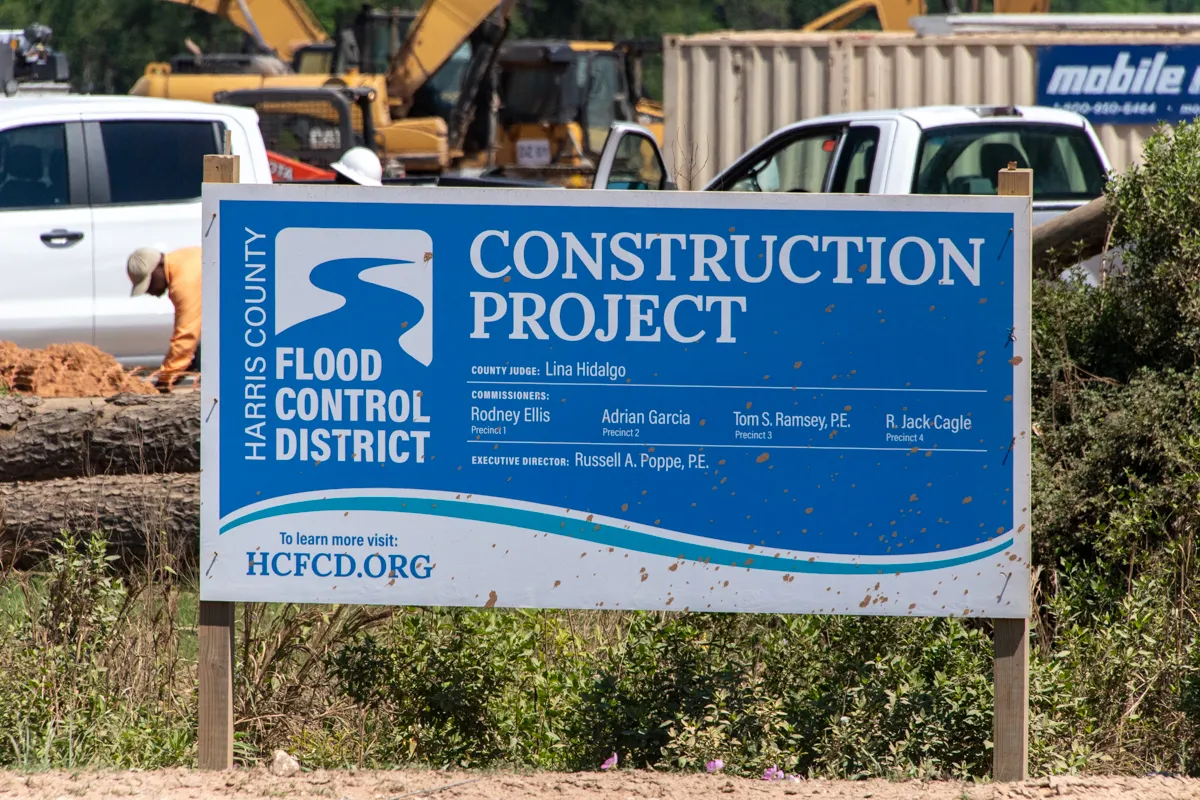
Greens Bayou Flood Mitigation Project Moves Forward as Construction Begins on Major Channel Improvements
Residents living along Greens Bayou will soon see construction activity ramp up as Harris County Flood Control District crews begin work on the first segment of a major flood risk reduction project designed to improve the bayou's ability to safely convey stormwater during heavy rainfall events.
The Greens Mid-Reach Channel Conveyance Improvements Project – Segment 1 represents another significant step in a decades-long effort to reduce flooding and improve resilience throughout the Greens Bayou watershed. For homeowners, businesses, and families who have experienced the impacts of severe weather, the project reflects continued investment in infrastructure intended to better manage stormwater and reduce flood risk across the region.
Construction activities are expected to begin soon and will include contractor mobilization, site preparation, and related work along approximately five miles of Greens Bayou between John F. Kennedy Boulevard and Aldine Westfield Road. Residents may notice construction crews accessing the project area from multiple locations along the bayou corridor.
Why This Project Matters
Flood mitigation projects often take years to plan, fund, and construct, but their impact can extend for generations.
The primary goal of the Greens Mid-Reach Channel Conveyance Improvements Project is to increase the capacity of Greens Bayou to move stormwater more efficiently during rainfall events. According to Harris County Flood Control District, Bond Project C-20 is designed to reduce water surface elevations within this portion of the bayou and contain at least a 10-year storm event within the channel banks.
For communities throughout the Greens Bayou watershed, improved channel conveyance can help reduce flooding risks, support public safety, and strengthen the area's ability to withstand future storm events.
One of Harris County's Largest and Most Flood-Prone Watersheds
The importance of this project extends well beyond the five-mile construction area. The Greens Bayou watershed is one of Harris County's largest and most populated watersheds, encompassing portions of Houston and Humble and serving more than 607,600 residents, according to 2020 Census data.
Covering approximately 212 square miles, the watershed includes roughly 308 miles of open streams and four primary waterways: Greens Bayou, Halls Bayou, Garners Bayou, and Reinhardt Bayou. Greens Bayou begins in north Harris County, flowing east before turning south toward the Houston Ship Channel.
Like many parts of Harris County, the watershed faces ongoing flood challenges. Significant development occurred before modern floodplain mapping and construction standards were established, leaving many homes, businesses, and transportation corridors vulnerable during major rainfall events. High-density development combined with extensive floodplain areas has contributed to repeated flooding throughout the watershed's history.

Part of a Much Larger Flood Resiliency Vision
Segment 1 is only one component of the broader Greens Bayou Mid-Reach Program, a several-hundred-million-dollar initiative that has been advancing for more than two decades.
The long-term program focuses on approximately 11 miles of Greens Bayou stretching from Veterans Memorial Drive downstream to JFK Boulevard. When fully realized, the program will include both channel improvements and stormwater detention projects designed to work together to reduce flood risks while minimizing downstream impacts.
The original vision includes:
- Approximately 11 miles of channel conveyance improvements
- More than 10,500 acre-feet of stormwater storage capacity
- Five major stormwater detention basins throughout the watershed
Significant progress has already been made.
More than 8,200 acre-feet of the planned stormwater detention capacity has been completed through projects including the Aldine Westfield Stormwater Detention Basin, Lauder Stormwater Detention Basin, Glen Forest Stormwater Detention Basin, and Kuykendahl Stormwater Detention Basin. Planning work continues on the future Hardy Stormwater Detention Basin, which is currently in the preliminary engineering phase.
Together, these projects form a comprehensive strategy aimed at reducing flood risks across one of Harris County's most developed watersheds.
Building on Decades of Flood Mitigation Efforts
The Greens Mid-Reach Program builds upon decades of flood control investments throughout the watershed.
Following the devastation caused by Tropical Storm Allison in 2001, Harris County Flood Control District accelerated flood risk reduction efforts across Greens Bayou. Those efforts took on renewed urgency after Hurricane Harvey in 2017, when Greens Bayou experienced the second-highest number of flooded homes of any watershed in Harris County, accounting for nearly 16 percent of all flooded homes countywide during the storm.
Today, more than $115.7 million has been allocated to flood mitigation projects throughout the Greens Bayou watershed through a combination of bond funding, Flood Control District resources, and partnership contributions. Officials report that all projects identified in the 2018 Bond Program for the watershed have been initiated.
As development continues in portions of north and west Harris County, flood mitigation infrastructure remains an important component of protecting existing neighborhoods while accommodating future growth.
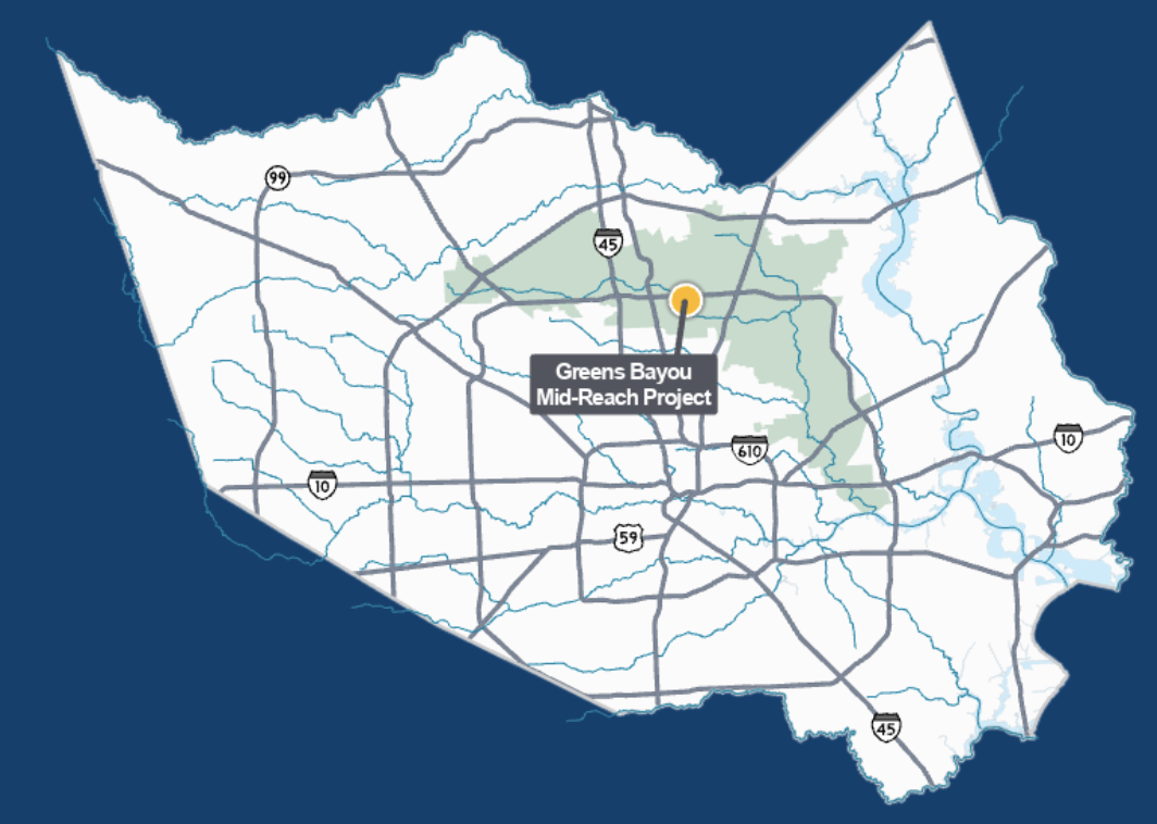 A map depicting the location of the Greens Bayou Mid-Reach Project. (Source: HCFCD)
A Comprehensive Approach to Flood Risk Reduction
The Flood Control District uses multiple tools to reduce flood risks throughout the watershed, including channel conveyance improvements, regional stormwater detention basins, environmental mitigation efforts, and regional partnerships.
In the upper portion of the watershed, the Flood Control District partnered with the U.S. Army Corps of Engineers on the Greens Bayou Federal Flood Risk Management Project, which included approximately 3.7 miles of channel improvements and construction of the Antoine Stormwater Detention Basin.
The current focus remains on the mid-reach section of Greens Bayou, where six regional stormwater detention basins are complete or under construction. These projects are estimated to reduce flood risk for approximately 4,500 structures located within the Atlas 14 100-year floodplain.
Meanwhile, Flood Control District teams continue studying the lower portion of the watershed to identify additional flood mitigation opportunities in coordination with community stakeholders and local leaders.
The watershed also contains important environmental assets. Near the confluence of Greens Bayou and Garners Bayou, Harris County established its first wetlands mitigation bank, helping offset unavoidable impacts to wetlands while preserving natural habitat and ecological functions.
Funding and Investment
The total estimated cost of the Greens Bayou Mid-Reach Program is approximately $78 million.
Funding for the effort comes from multiple sources, including:
- Approximately $8.2 million from the Harris County Flood Control District's 2018 Bond Program
- Up to $70 million through the Community Development Block Grant – Disaster Recovery (CDBG-DR) program, funded by the U.S. Department of Housing and Urban Development and administered by the Texas General Land Office
The construction contract for Segment 1 was awarded at $16.6 million.
The partnership between local, state, and federal agencies has allowed large-scale flood mitigation projects like this one to move from planning into construction. Harris County Flood Control District has also pursued additional partnership opportunities throughout the watershed, submitting applications for nearly $395 million in potential federal, state, regional, and local funding to support future flood risk reduction projects.
Construction Timeline
According to Harris County Flood Control District, the anticipated schedule for Segment 1 includes:
- Construction Start: Second Quarter 2026
- Construction Completion: Second Quarter 2027
During construction, residents may experience increased activity near project access points along the bayou. Officials note that construction crews will be working from multiple locations between JFK Boulevard and Aldine Westfield Road.
What Happens Next
As work progresses, Harris County Flood Control District will continue advancing additional segments of the Greens Mid-Reach Channel Conveyance Improvements Project.
While flood mitigation infrastructure often operates out of sight, projects like this play an important role in protecting homes, businesses, roads, schools, and community assets during future storm events. As the region continues to grow and weather patterns remain unpredictable, investments in drainage improvements and flood resilience infrastructure remain a key focus for local leaders and flood control officials.
Residents who observe issues related to Flood Control District facilities or projects can submit a service request online through Harris County Flood Control District or call 346-286-4197.
The Flood Control District says it remains committed to the long-term vision of improving flood resilience throughout the Greens Bayou watershed and continues to work alongside federal, state, and local partners to advance projects that help protect communities across north Harris County.
For updates on important infrastructure projects, flood mitigation efforts, and community developments affecting local neighborhoods, stay connected with My Neighborhood News.

 Tiffany Krenek has been on the My Neighborhood News team since August 2021. She is passionate about curating and sharing content that enriches the lives of our readers in a personal, meaningful way. A loving mother and wife, Tiffany and her family live in the West Houston/Cypress region.