Extreme Heat Warning Followed by Heat Advisory Across Greater Houston Area; Storms May Bring Flooding Risk This Weekend
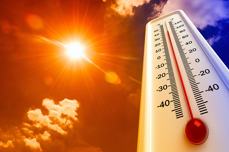
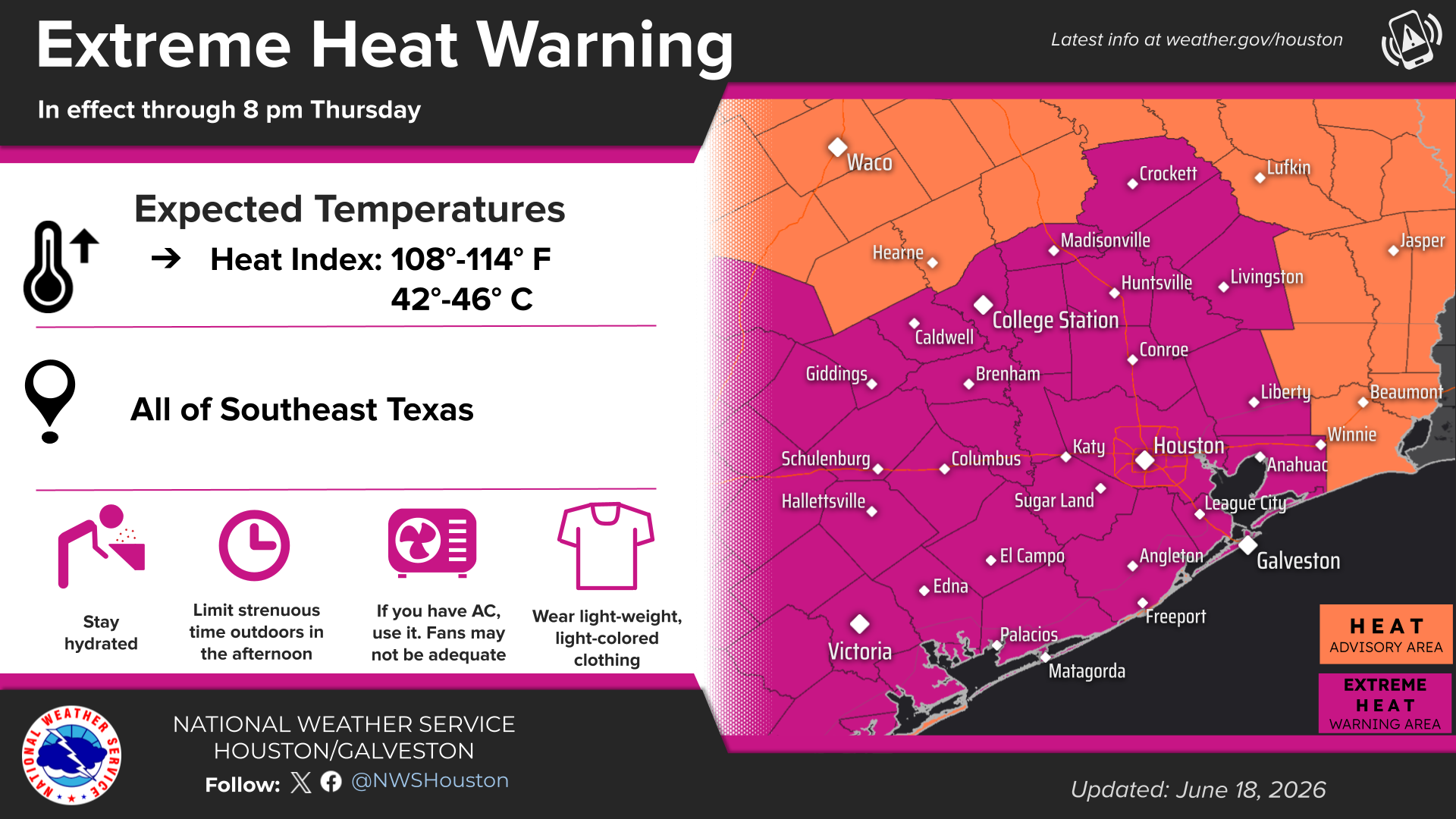
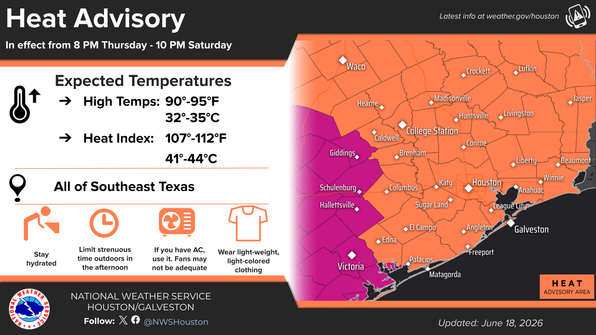
Residents across the Greater Houston region, including Harris County, Fort Bend County, Montgomery County and surrounding communities, are being urged to take precautions as a prolonged stretch of dangerous heat settles over Southeast Texas. The National Weather Service Houston/Galveston office has issued an Extreme Heat Warning through 8 p.m. Thursday, followed by a Heat Advisory from 8 p.m. Thursday through 10 p.m. Saturday as heat index values climb well above 100 degrees.
For families heading outdoors, youth sports participants, construction workers, landscapers and anyone spending extended time outside, the next several days could present serious health risks. Forecasters expect heat index values — what the temperature feels like when humidity is factored in — to range from 108 to 114 degrees Thursday and Friday, with values between 106 and 112 degrees continuing through the weekend.
Why This Heat Event Matters
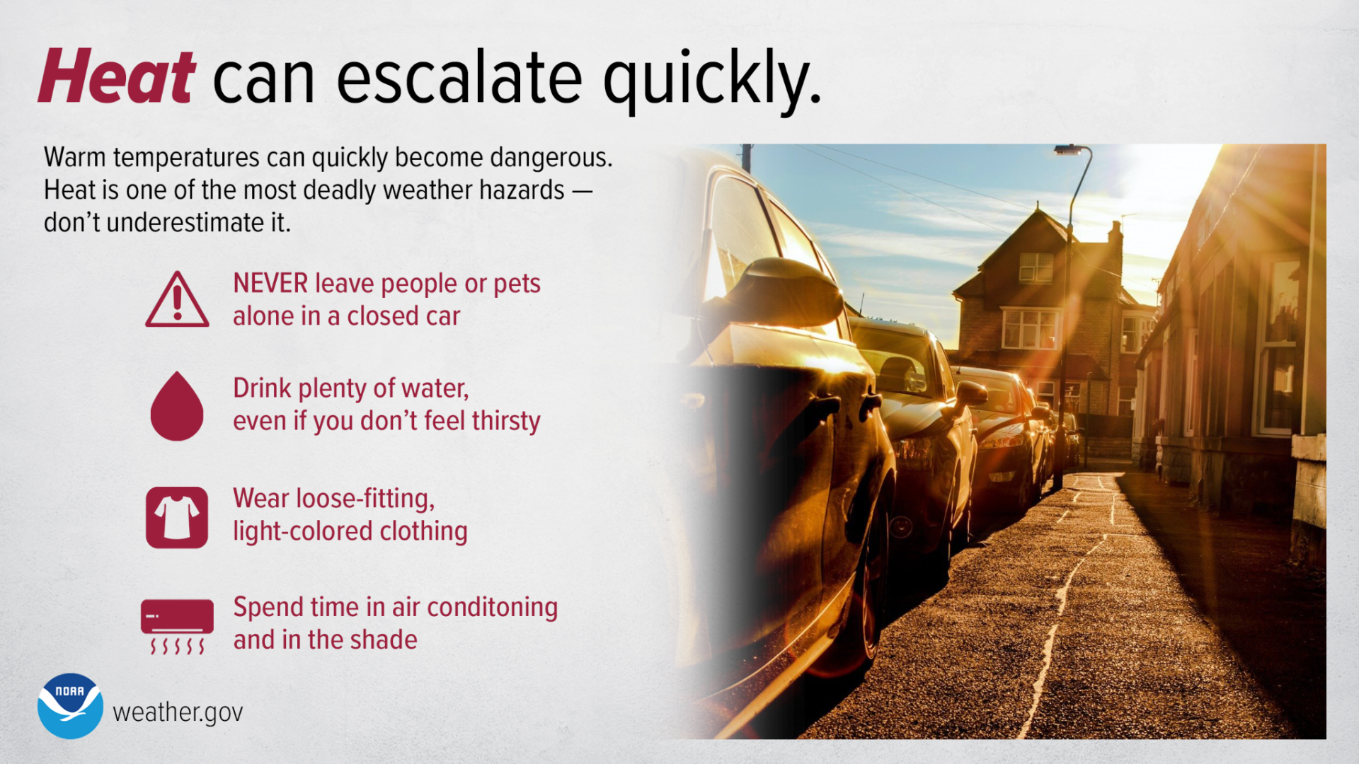
While most residents are accustomed to summer heat, the combination of high temperatures and humidity significantly increases the risk of heat-related illnesses. According to the National Weather Service, heat can escalate quickly, especially for children, older adults, outdoor workers and individuals with underlying health conditions.
The warning covers much of Southeast Texas, including the Houston metropolitan area, where residents are being encouraged to limit strenuous outdoor activities during the hottest parts of the day, typically between noon and early evening.
In neighborhoods across the region, simple actions can make a significant difference. Checking on elderly neighbors, ensuring pets have access to shade and water, and making sure children are never left in vehicles can help prevent emergencies during periods of extreme heat.
Heat Safety Tips for Residents
The National Weather Service Houston/Galveston office is emphasizing several key safety measures:
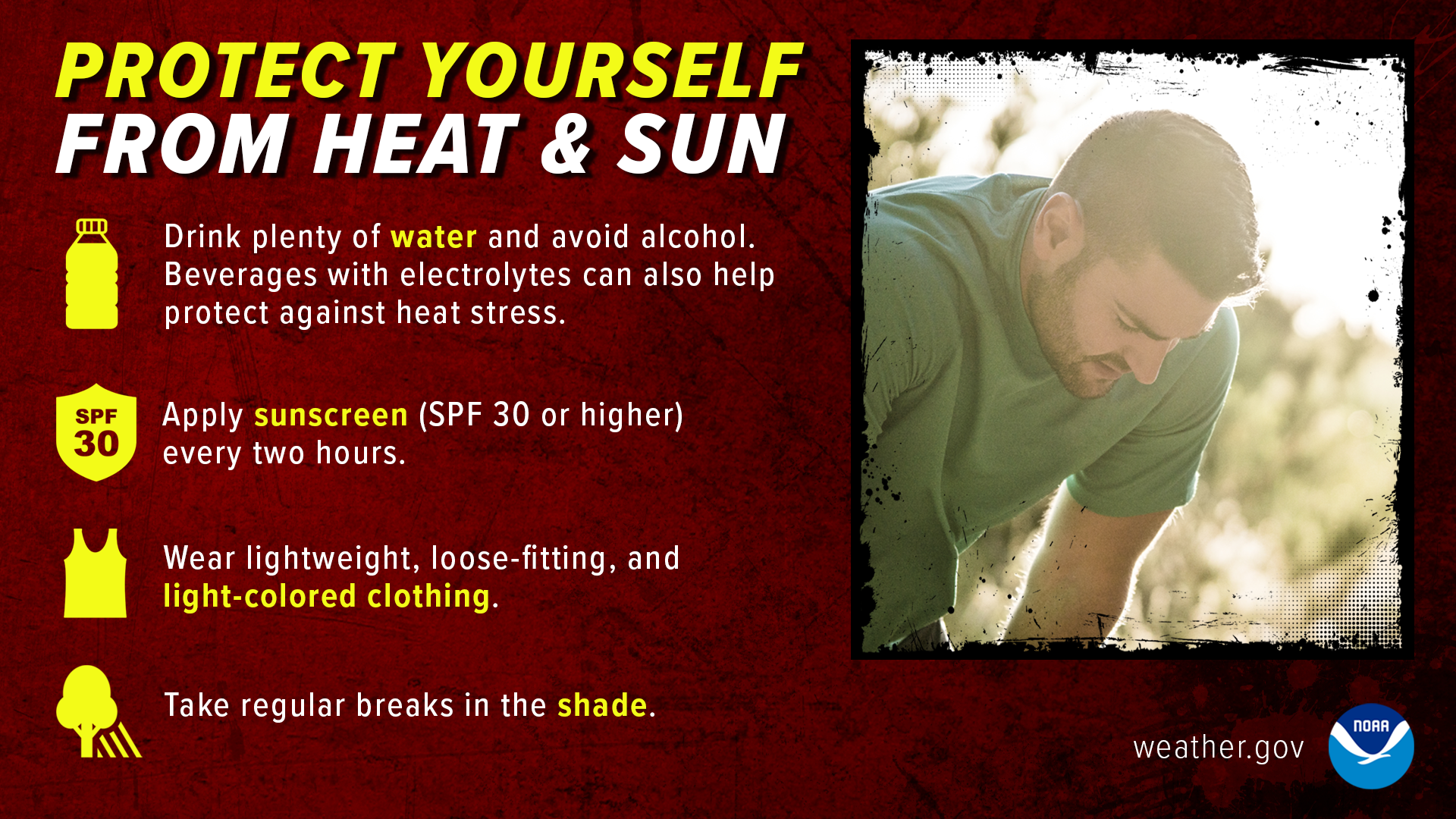
- Limit outdoor activities, especially during the afternoon.
- Drink plenty of water, even if you do not feel thirsty.
- Wear lightweight, loose-fitting, light-colored clothing.
- Apply sunscreen and seek shade when possible.
- Spend time in air-conditioned environments whenever available.
- Check your backseat before locking your vehicle to ensure no children or pets remain inside.
- Check on elderly neighbors, family members and anyone who may be vulnerable to heat-related illness.
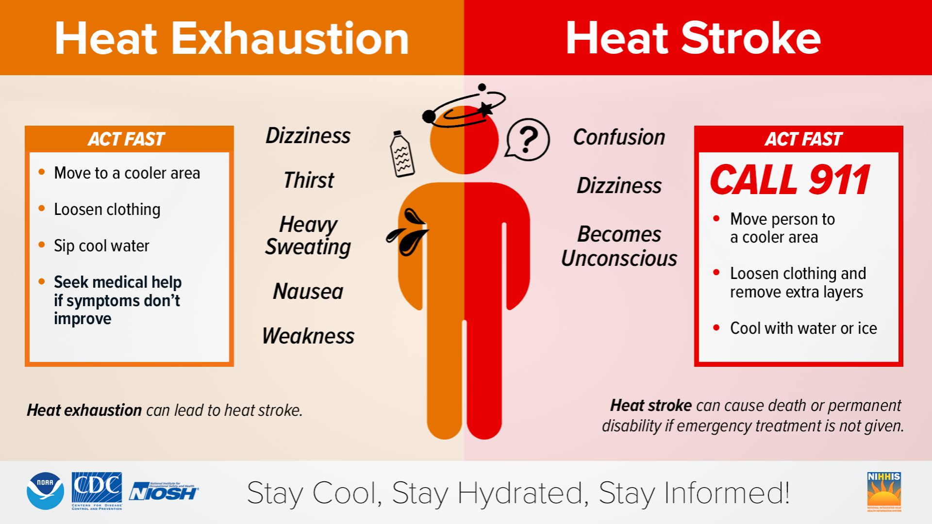
Residents should also be aware of the warning signs of heat exhaustion, which can include dizziness, heavy sweating, nausea, weakness and excessive thirst. If symptoms worsen or confusion develops, emergency medical assistance may be needed, as heat stroke can become life-threatening.
Rain and Flooding Risk Returns Late Friday
While the heat remains the primary concern, forecasters are also monitoring a weather disturbance expected to move into the region late Friday.
The National Weather Service has identified a Slight Risk (Level 2 of 4) for excessive rainfall across portions of Southeast Texas, primarily for areas along and north of Interstate 10. The greatest potential for heavy rainfall is expected from Friday night into Saturday morning.
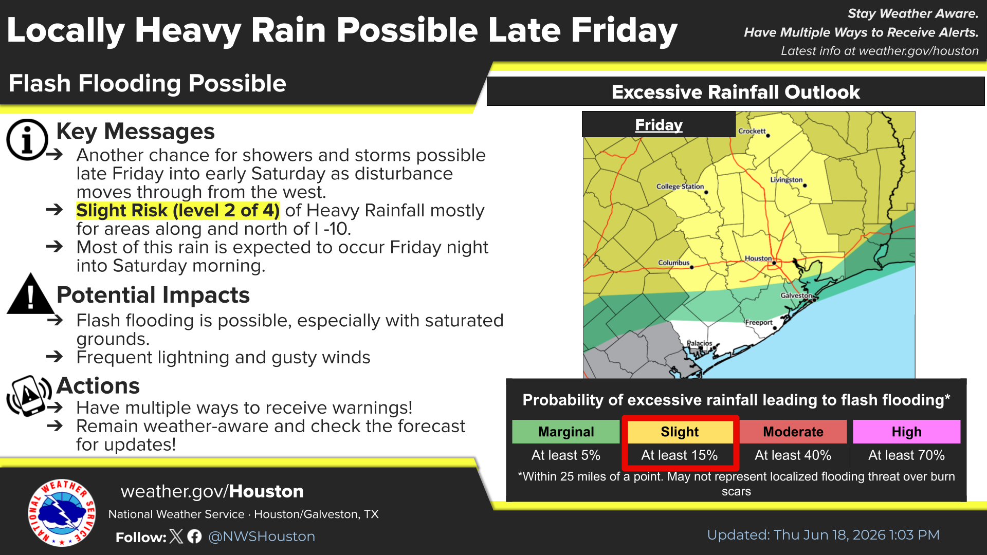
Because many locations remain saturated from recent rainfall, even localized heavy downpours could produce flash flooding, particularly in low-lying areas, neighborhoods with poor drainage and locations that have experienced repeated rain events in recent weeks.
Forecasters also note that thunderstorms could produce frequent lightning and gusty winds.
What Residents Should Watch For
The weather pattern heading into the weekend presents a combination of hazards that Southeast Texas residents know well: dangerous heat followed by the possibility of heavy rain.
Residents are encouraged to monitor forecasts regularly, enable emergency weather alerts on mobile devices, and have multiple ways to receive warnings should flash flood watches or warnings become necessary.
For many communities across the Greater Houston area, staying weather-aware over the next several days will mean balancing heat safety during the day while remaining alert for changing conditions Friday night and Saturday morning.
What Happens Next
The Extreme Heat Warning remains in effect until 8 p.m. Thursday, after which a Heat Advisory will continue through 10 p.m. Saturday. Additional forecast updates may be issued if rainfall expectations increase or if heat conditions worsen.
Residents can monitor the latest forecasts, advisories and warnings from the National Weather Service Houston/Galveston office at weather.gov/houston.
Stay tuned to My Neighborhood News for additional weather updates affecting the Greater Houston area.
 Tiffany Krenek has been on the My Neighborhood News team since August 2021. She is passionate about curating and sharing content that enriches the lives of our readers in a personal, meaningful way. A loving mother and wife, Tiffany and her family live in the West Houston/Cypress region.