Governor Abbott Issues Disaster Declaration for 101 Texas Counties, Including Harris, Fort Bend and Montgomery
For residents across Harris County, Fort Bend County, Montgomery County and much of Southeast Texas, Governor Greg Abbott's latest disaster declaration signals the seriousness of a weather event that continues to evolve by the hour. With neighborhoods already experiencing periods of heavy rain and flooding concerns, the declaration opens access to additional state resources and emergency support as communities brace for more potentially dangerous weather in the days ahead.
The declaration covers 101 Texas counties affected by the severe weather event that began June 14 and includes threats from heavy rainfall, flash flooding, hazardous wind gusts, large hail and possible tornadoes. Harris, Fort Bend and Montgomery counties are among those included. Governor Abbott said the declaration is intended to help local officials respond quickly as storm impacts continue across the state.
"Texas is prepared to respond to the severe weather threats that continue to move across our state," Abbott said. "Because of the impact caused by ongoing storms and flood risks, I have issued a disaster declaration for 101 Texas counties to ensure that local officials and communities have access to the full range of state resources and support."
National Weather Service Warns Flooding Threat Remains High
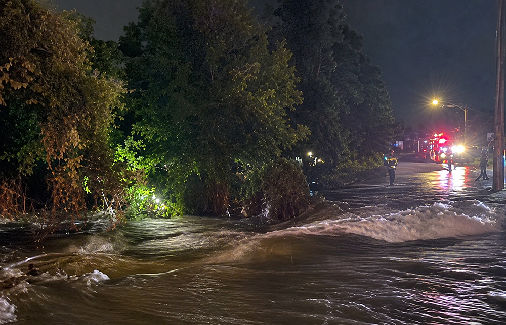
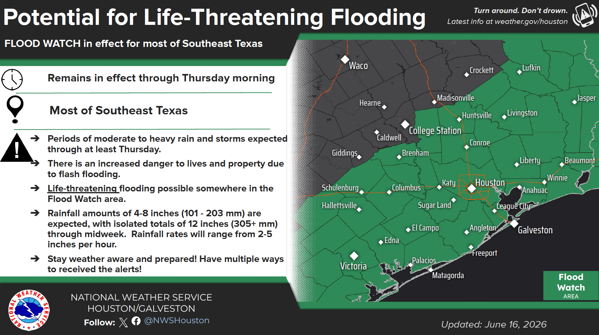
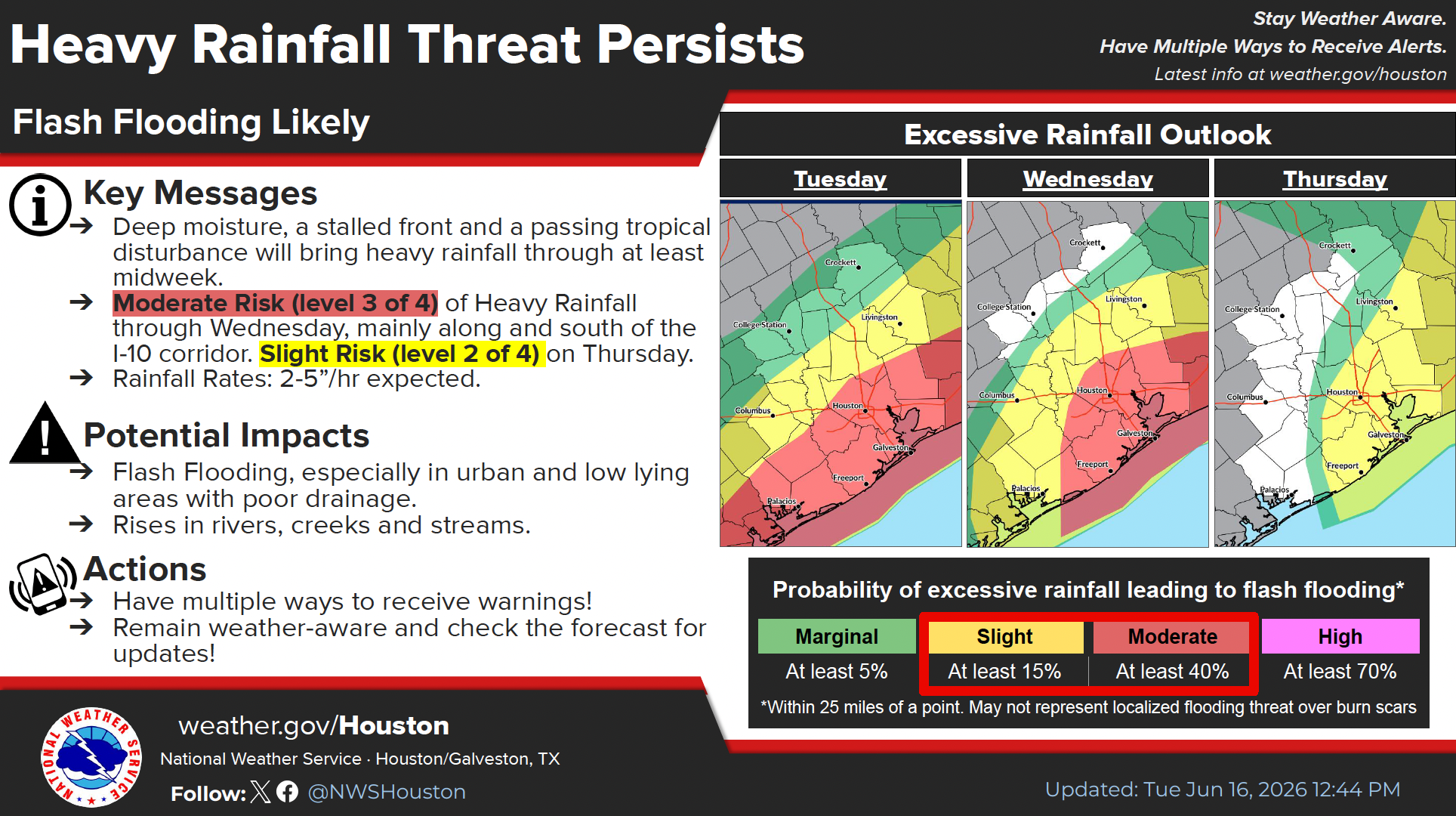
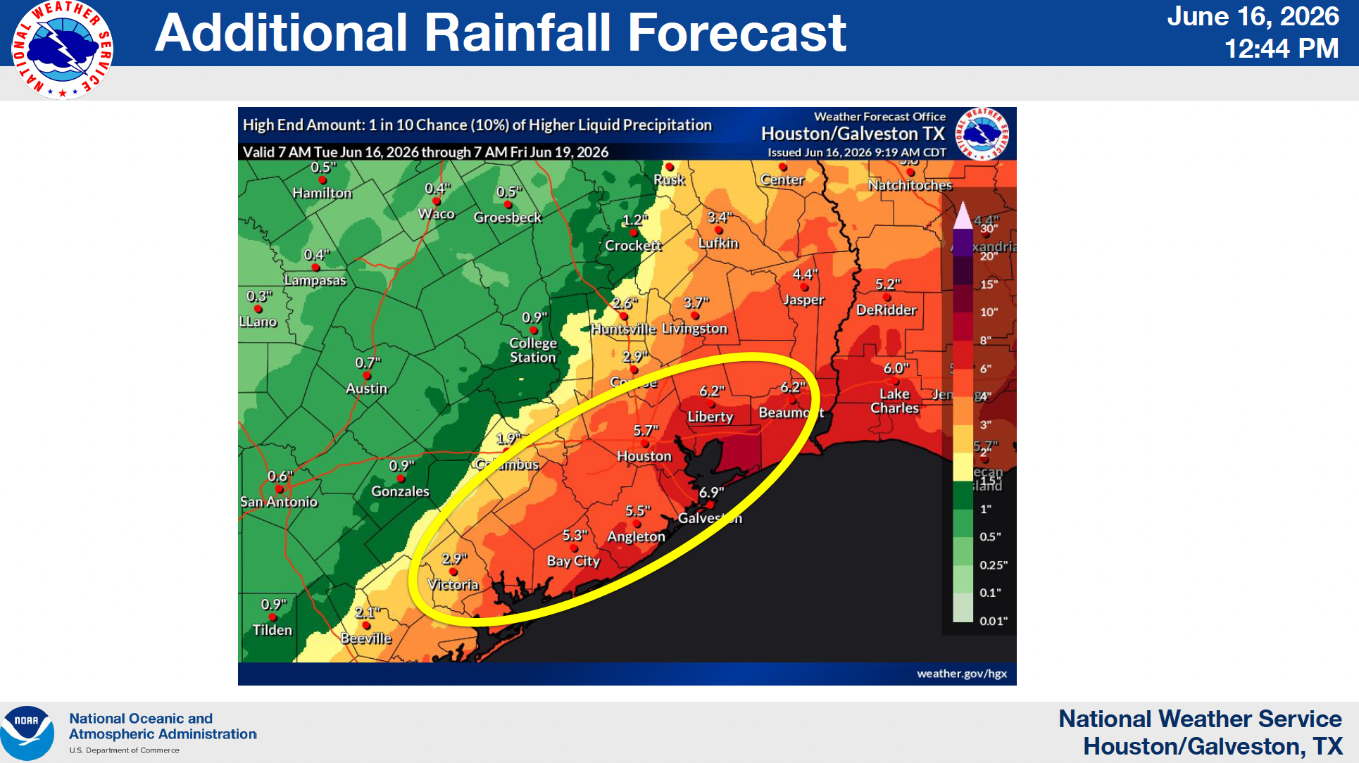
The governor's announcement comes as the National Weather Service Houston/Galveston office continues to warn that life-threatening flooding remains possible through at least Thursday across much of Southeast Texas. Forecasters said an additional 4 to 7 inches of rain could fall across the region, with isolated locations potentially receiving 10 to 15 inches on top of rainfall already recorded. Rainfall rates could reach 2 to 5 inches per hour in the strongest storms, creating conditions favorable for flash flooding in neighborhoods, streets, bayous and low-lying areas.
According to the National Weather Service's latest briefing, a Flood Watch remains in effect for most of Southeast Texas through Thursday morning. Meteorologists continue to highlight an increased danger to lives and property due to flash flooding, particularly in urban areas and locations with poor drainage. The agency has also warned that rivers, creeks and streams could experience significant rises as runoff continues.
For many residents, the concern extends beyond a single day of rain. The National Weather Service noted that prolonged periods of moderate to heavy rainfall are expected through at least Thursday, increasing the likelihood that flooding impacts could compound over time.

Potential Tropical Cyclone One Adds Another Layer of Concern
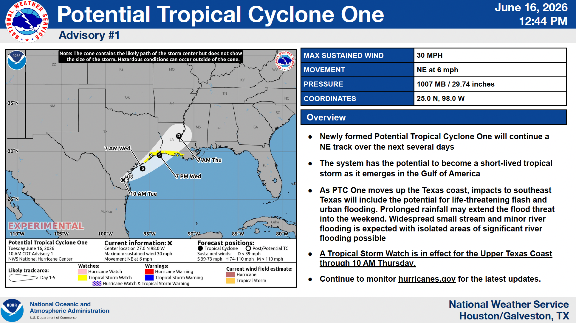
Adding to the forecast challenge, the National Hurricane Center has begun issuing advisories for Potential Tropical Cyclone One, a system currently moving northeast along the Texas coast. Forecasters expect the system to strengthen into Tropical Storm Arthur as it moves over Gulf waters before making landfall near the Texas-Louisiana border Wednesday evening.
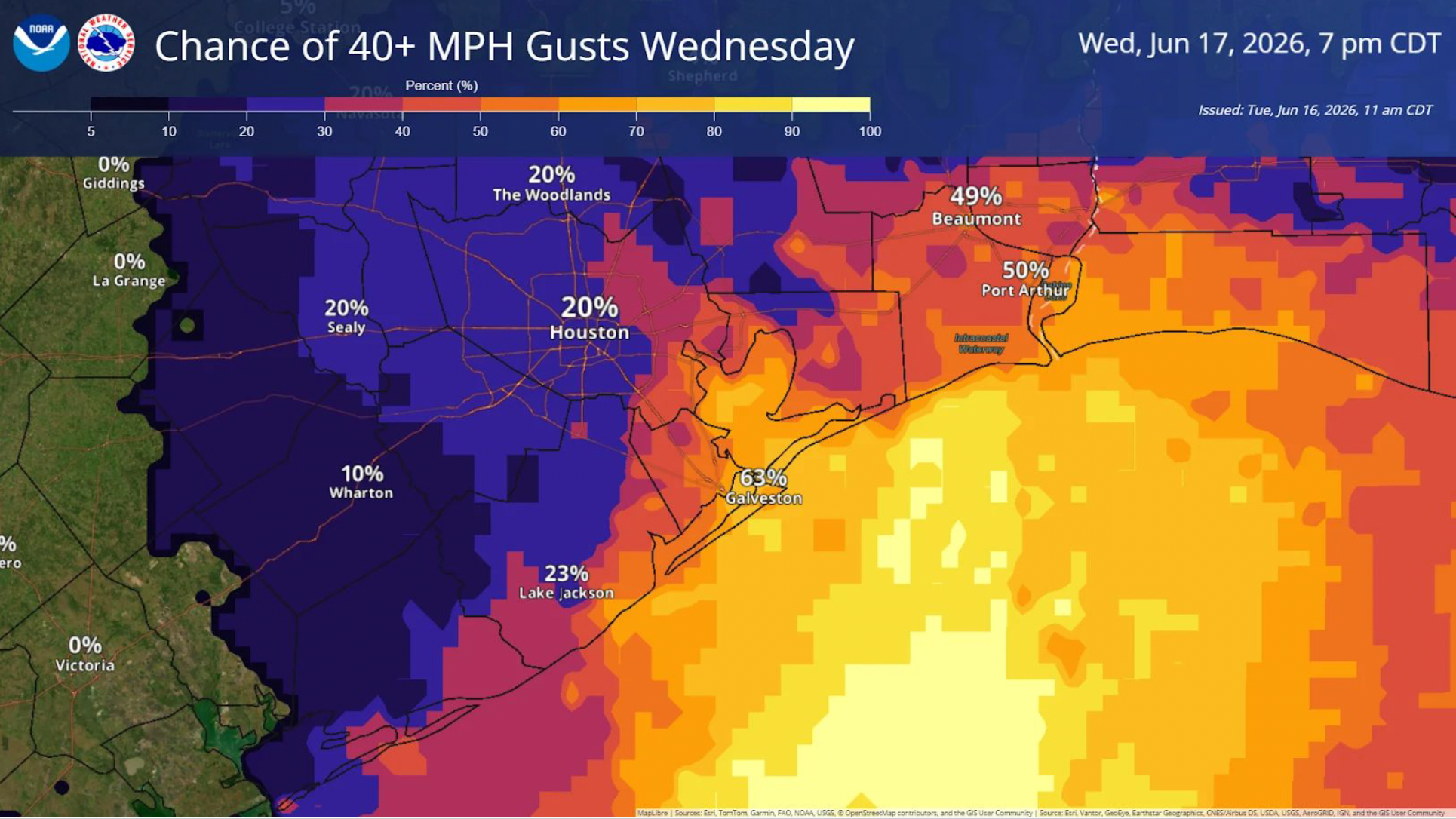
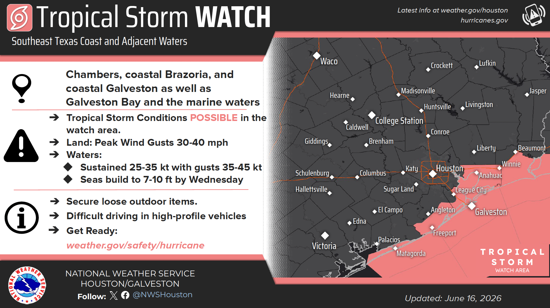
While the primary threat for inland communities remains flooding rainfall, the storm could also bring gusty winds and coastal impacts. The National Weather Service said wind gusts of 30 to 40 mph are possible near the coast, while Tropical Storm Watches have been issued for portions of Chambers, Brazoria and Galveston counties. Minor coastal flooding is also expected along portions of the Upper Texas Coast, particularly around high tide cycles Wednesday.
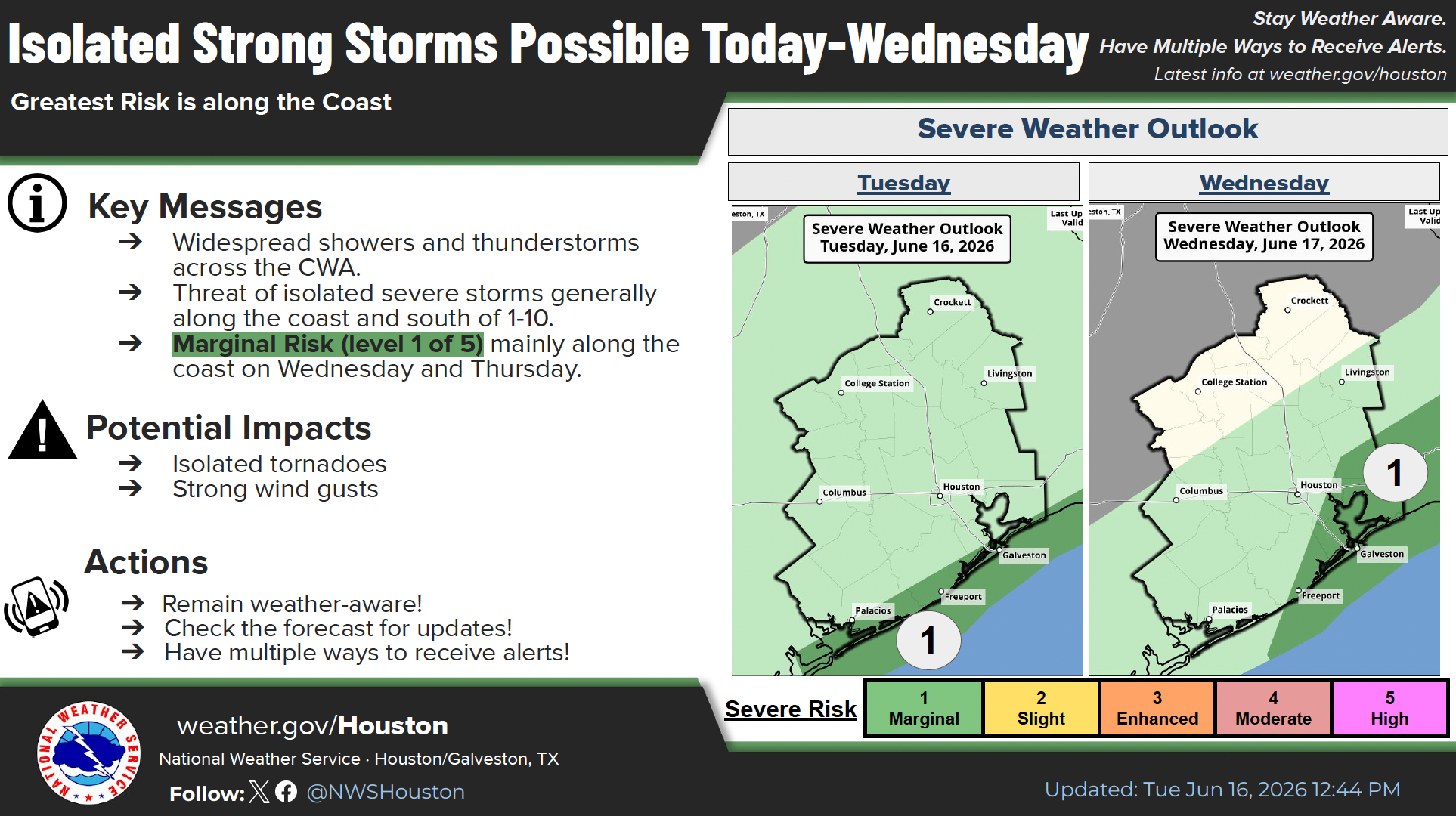
Forecasters have also identified a marginal risk for isolated severe storms capable of producing tornadoes and damaging wind gusts, especially closer to the coast and south of Interstate 10.
State Emergency Operations Activated Around the Clock
In response to the ongoing threat, Governor Abbott directed the Texas Division of Emergency Management to activate additional state emergency response resources and implement 24-hour operations at the Texas State Emergency Operations Center. The move follows actions taken last week to pre-position personnel and equipment ahead of the anticipated flooding threat.
The declaration allows state agencies to coordinate more closely with local governments and emergency management officials as conditions develop. It also helps ensure resources can be deployed quickly if flooding worsens or additional counties require assistance.
For local communities, the announcement underscores the importance of remaining vigilant even during breaks in the rain. Weather officials stress that flash flooding can develop rapidly, especially when multiple rounds of heavy rainfall move over the same areas.

What Residents Should Know
Emergency officials continue urging residents to monitor forecasts closely, enable weather alerts on mobile devices and avoid driving through flooded roadways. The National Weather Service's message remains clear: "Turn Around, Don't Drown."
Texans can find severe weather safety information at TexasReady.gov, check roadway conditions at DriveTexas.org and access preparedness resources through the Texas Division of Emergency Management.
With additional rainfall expected, floodwaters already elevated in some areas and a developing tropical system tracking along the Texas coast, Southeast Texas residents are being encouraged to remain prepared and stay informed as the weather situation continues to unfold through midweek and beyond.
Residents can stay tuned to My Neighborhood News for continuing updates on severe weather, flooding conditions and emergency information affecting communities across Southeast Texas.
 Tiffany Krenek has been on the My Neighborhood News team since August 2021. She is passionate about curating and sharing content that enriches the lives of our readers in a personal, meaningful way. A loving mother and wife, Tiffany and her family live in the West Houston/Cypress region.