







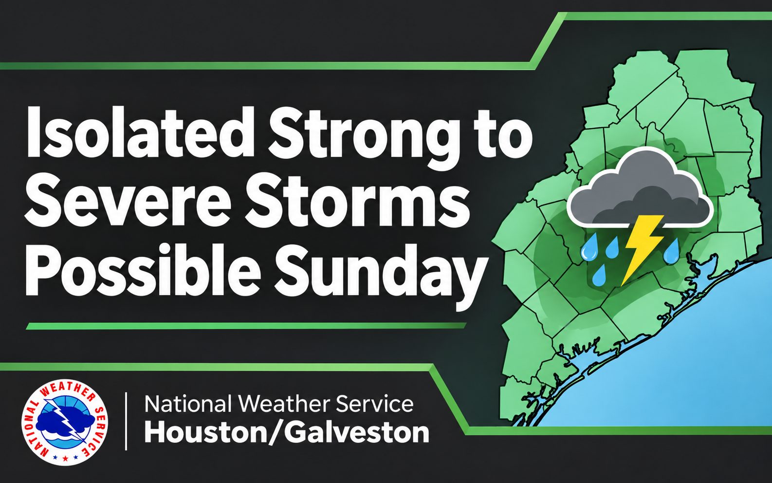
Heavy Rain, Strong Storms and Street Flooding Possible Sunday: What Eagle Landing Residents Should Know
Sunday plans across the Greater Houston area may need a little flexibility this weekend. From church services and family outings to grocery shopping and getting ready for the school week, residents in Eagle Landing could encounter periods of heavy rain, thunderstorms and potentially flooded roadways as a strong weather system moves across Southeast Texas.
The National Weather Service (NWS) Houston/Galveston is forecasting widespread showers and thunderstorms for Sunday, November 15, 2026, with locally heavy rainfall, gusty winds and a possibility of isolated severe storms. While widespread flooding is not currently anticipated, forecasters are monitoring the potential for minor street flooding and rapidly accumulating water in low-lying areas and neighborhoods with poor drainage.
The greatest concern is how quickly rain could fall in certain locations. Even neighborhoods that typically handle moderate rainfall without difficulty could experience temporary street flooding if heavy thunderstorms repeatedly move across the same area.
When Will Heavy Rain and Thunderstorms Arrive in Houston?
The weekend is expected to begin relatively quietly for much of the Houston metropolitan area before conditions become increasingly unsettled.
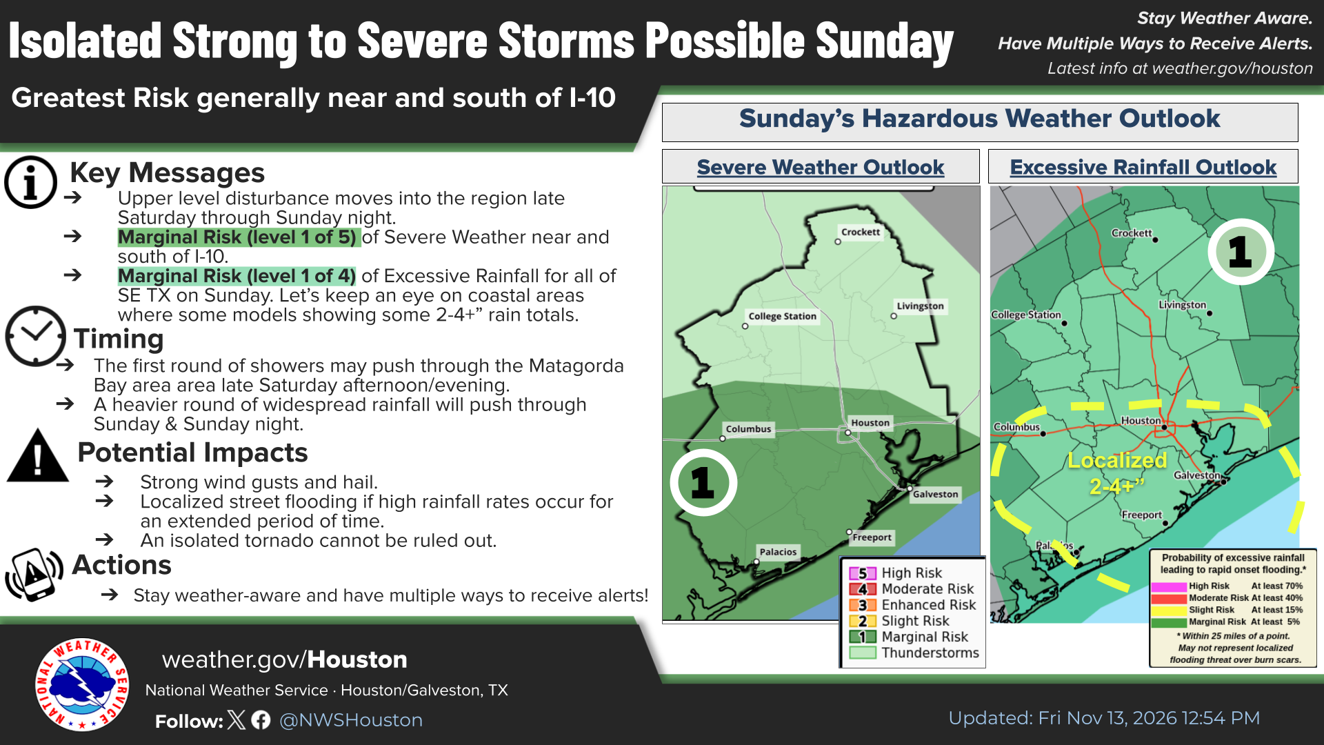
The first round of showers could develop around the Matagorda Bay area late Saturday afternoon or evening, November 14. Rain chances will increase across Southeast Texas as a cold front approaches, bringing warm, moisture-rich air inland from the Gulf.
Sunday, November 15, is expected to bring the greatest potential for widespread rainfall and thunderstorms, particularly from late morning through the afternoon. Additional rain could continue into Sunday night.
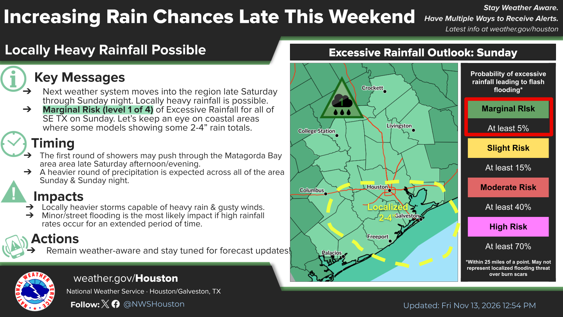
According to the National Weather Service, much of Southeast Texas could receive 1 to 3 inches of rainfall, while some coastal locations could see totals exceeding 4 inches.
During particularly intense thunderstorms, rainfall rates could temporarily exceed 2 to 3 inches per hour. That does not mean every neighborhood will experience those amounts, but it explains why localized flooding could develop relatively quickly.
The approaching cold front is expected to move through Southeast Texas late Sunday night into early Monday morning, November 16.
What Is the Flood Risk for Southeast Texas on Sunday?
The National Weather Service reports that the Weather Prediction Center has placed all of Southeast Texas under a Marginal Risk for excessive rainfall, Level 1 of 4, for Sunday.
This is the lowest category on the excessive rainfall risk scale, indicating that isolated flash flooding is possible rather than widespread flooding being expected.
For homeowners and drivers in Eagle Landing, the distinction matters. The primary concern is not necessarily rising water inside homes, but localized conditions that can make familiar neighborhood streets, intersections, parking lots and low-water crossings hazardous.
Forecasters indicate that creeks and bayous are generally not expected to exceed their banks. However, repeated rounds of heavy rain could cause water levels to rise quickly, while overwhelmed drainage systems could result in water collecting on roads.
Even relatively shallow standing water creates problems for drivers, increasing the risk of hydroplaning and potentially leaving vehicles stranded in low-lying areas.
Strong to Severe Thunderstorms Also Possible Near and South of I-10
Flooding is not the only weather concern.
The Storm Prediction Center has placed portions of Southeast Texas, generally near and south of Interstate 10, under a Marginal Risk for severe weather, Level 1 of 5, on Sunday.
Although this represents the lowest category on the severe weather risk scale, some thunderstorms could produce damaging wind gusts and severe hail. Forecasters also indicate that an isolated tornado cannot be ruled out.
Not every thunderstorm will become severe, and the risk will vary by location. Residents should nevertheless remain attentive to changing conditions, especially if outdoor activities or travel are planned.
Gusty Winds Expected Saturday Night Through Monday
Winds are also expected to increase ahead of the approaching cold front.
Beginning as early as Saturday night, onshore winds could reach 15 to 20 mph, with gusts approaching 30 mph in some locations.
Coastal counties and barrier islands could experience particularly windy conditions. The National Weather Service indicates that a Wind Advisory may be issued as early as Saturday night and could remain in effect through Monday.
Once the cold front moves offshore late Sunday night or early Monday morning, gusty northeasterly winds are expected to continue along the coast.
For residents planning trips to Galveston or other coastal destinations this weekend, keeping an eye on updated marine forecasts and local weather advisories will be especially important.

How Residents Can Prepare Before Sunday's Heavy Rain
A few simple precautions before the rain arrives can help families avoid unnecessary difficulties during the weekend.
Homeowners can check that drainage areas on their property are clear of leaves and other debris, secure lightweight outdoor decorations and furniture, and make sure phones and other essential devices are charged.
Residents who know certain streets or intersections in their neighborhood tend to collect water during heavy rain may want to plan alternate routes before heading out Sunday.
Drivers should also remember that flooded roadways can be difficult to judge. A familiar street may look passable even when water is deep enough to disable a vehicle.
The National Weather Service recommends driving cautiously, monitoring weather and road conditions, and remaining especially alert for standing water that increases the possibility of hydroplaning.
Families with Sunday activities may also benefit from allowing additional travel time, keeping an indoor backup plan and checking the forecast before leaving home.
Where to Find Houston Weather Alerts and Flooding Updates
Because the timing and intensity of thunderstorms can change as a weather system approaches, the National Weather Service encourages Southeast Texas residents to have multiple ways to receive weather alerts.
Residents can monitor official forecasts, watches and warnings through the National Weather Service Houston/Galveston office.
For those in Harris County, the Harris County Flood Control District's Flood Warning System provides near-real-time information about rainfall totals and water levels in local creeks, bayous and drainage channels.
The system also allows residents to sign up for rainfall and water-level notifications by email or text message, offering another way to monitor conditions near their homes, workplaces and regular travel routes.
Residents should remember that a Marginal Risk outlook is not the same as a flood warning or severe thunderstorm warning. Any watches or warnings issued as conditions develop will provide more specific information about immediate hazards.
What Happens After Sunday's Storms?
The cold front is expected to move through Southeast Texas late Sunday night into early Monday, gradually bringing an end to the widespread rain threat and ushering in cooler, drier conditions.
However, lingering rain and gusty winds could still affect portions of the region Monday morning, making it worthwhile for commuters and families to check road conditions before heading to work or school.
For residents in Eagle Landing, the takeaway is straightforward: Sunday could be a wet and occasionally stormy day, but preparing ahead of time and staying informed can make a meaningful difference.
The next day or two will provide a clearer picture of which areas face the greatest rainfall and thunderstorm risks. Until then, keeping weekend plans flexible and paying attention to trusted weather sources are sensible precautions.
Stay connected with My Neighborhood News for the latest local updates, community safety information and important developments affecting neighborhoods across Greater Houston.

 Tiffany Krenek has been on the My Neighborhood News team since August 2021. She is passionate about curating and sharing content that enriches the lives of our readers in a personal, meaningful way. A loving mother and wife, Tiffany and her family live in the West Houston/Cypress region.

Local business spotlight
Grow your business
where trust already lives.
Let’s introduce your business to the neighbors nearby.
Have a local favorite?
Let’s make an introduction.
Leave your email and our team will reach out with ways to promote your business.
Give a local favorite a little love.
Know a business your neighbors should discover? Tell us who they are.
We couldn’t send that just yet. Please try again.